Monflanquin | |
|---|---|
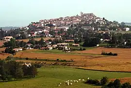 A general view of Monflanquin | |
.svg.png.webp) Coat of arms | |
Location of Monflanquin | |
 Monflanquin  Monflanquin | |
| Coordinates: 44°31′59″N 0°46′07″E / 44.5331°N 0.7686°E | |
| Country | France |
| Region | Nouvelle-Aquitaine |
| Department | Lot-et-Garonne |
| Arrondissement | Villeneuve-sur-Lot |
| Canton | Le Haut agenais Périgord |
| Intercommunality | Bastides en Haut-Agenais Périgord |
| Government | |
| • Mayor (2020–2026) | Nathalie Founaud-Veysset[1] |
| Area 1 | 62.21 km2 (24.02 sq mi) |
| Population | 2,350 |
| • Density | 38/km2 (98/sq mi) |
| Time zone | UTC+01:00 (CET) |
| • Summer (DST) | UTC+02:00 (CEST) |
| INSEE/Postal code | 47175 /47150 |
| Elevation | 64–207 m (210–679 ft) (avg. 181 m or 594 ft) |
| 1 French Land Register data, which excludes lakes, ponds, glaciers > 1 km2 (0.386 sq mi or 247 acres) and river estuaries. | |
Monflanquin (French pronunciation: [mɔ̃flɑ̃kɛ̃]; Languedocien: Montflanquin) is a commune in the Lot-et-Garonne department in south-western France. Built in 1256 as a military bastide town on a strategic north-south route, it changed hands several times during the Hundred Years' War.
The village is a member of the Les Plus Beaux Villages de France ("The most beautiful villages of France") association.
Demography
| Year | Pop. | ±% p.a. |
|---|---|---|
| 1968 | 2,354 | — |
| 1975 | 2,368 | +0.08% |
| 1982 | 2,356 | −0.07% |
| 1990 | 2,431 | +0.39% |
| 1999 | 2,258 | −0.82% |
| 2007 | 2,342 | +0.46% |
| 2012 | 2,345 | +0.03% |
| 2017 | 2,313 | −0.27% |
| Source: INSEE[3] | ||
Notable people
- Louis Couffignal (1902-1966), mathematician and cybernetics pioneer
See also
References
- ↑ "Répertoire national des élus: les maires". data.gouv.fr, Plateforme ouverte des données publiques françaises (in French). 2 December 2020.
- ↑ "Populations légales 2021". The National Institute of Statistics and Economic Studies. 28 December 2023.
- ↑ Population en historique depuis 1968, INSEE
External links
Wikimedia Commons has media related to Monflanquin.
- Monflanquin bastide modèle - Georges Odo
This article is issued from Wikipedia. The text is licensed under Creative Commons - Attribution - Sharealike. Additional terms may apply for the media files.