Saint-Pierre | |
|---|---|
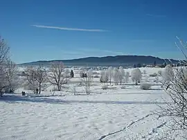 A general view of Saint-Pierre in winter | |
Location of Saint-Pierre | |
 Saint-Pierre  Saint-Pierre | |
| Coordinates: 46°34′12″N 5°55′13″E / 46.57000°N 5.92028°E | |
| Country | France |
| Region | Bourgogne-Franche-Comté |
| Department | Jura |
| Arrondissement | Saint-Claude |
| Canton | Saint-Laurent-en-Grandvaux |
| Government | |
| • Mayor (2020–2026) | Liliane Faivre[1] |
| Area 1 | 16.37 km2 (6.32 sq mi) |
| Population | 365 |
| • Density | 22/km2 (58/sq mi) |
| Time zone | UTC+01:00 (CET) |
| • Summer (DST) | UTC+02:00 (CEST) |
| INSEE/Postal code | 39494 /39150 |
| Elevation | 846–1,135 m (2,776–3,724 ft) |
| 1 French Land Register data, which excludes lakes, ponds, glaciers > 1 km2 (0.386 sq mi or 247 acres) and river estuaries. | |
Saint-Pierre (French pronunciation: [sɛ̃ pjɛʁ] ⓘ) is a commune in the Jura department in the Bourgogne-Franche-Comté region in eastern France.[3]
Population
| Year | Pop. | ±% p.a. |
|---|---|---|
| 1968 | 163 | — |
| 1975 | 185 | +1.83% |
| 1982 | 204 | +1.41% |
| 1990 | 239 | +2.00% |
| 1999 | 316 | +3.15% |
| 2009 | 321 | +0.16% |
| 2014 | 333 | +0.74% |
| 2020 | 368 | +1.68% |
| Source: INSEE[4] | ||
See also
References
- ↑ "Répertoire national des élus: les maires". data.gouv.fr, Plateforme ouverte des données publiques françaises (in French). 2 December 2020.
- ↑ "Populations légales 2021". The National Institute of Statistics and Economic Studies. 28 December 2023.
- ↑ INSEE commune file
- ↑ Population en historique depuis 1968, INSEE
Wikimedia Commons has media related to Saint-Pierre (Jura).
This article is issued from Wikipedia. The text is licensed under Creative Commons - Attribution - Sharealike. Additional terms may apply for the media files.