Villette-lès-Dole | |
|---|---|
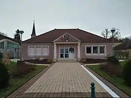 The town hall in Villette-lès-Dole | |
 Coat of arms | |
Location of Villette-lès-Dole | |
 Villette-lès-Dole  Villette-lès-Dole | |
| Coordinates: 47°02′56″N 5°29′43″E / 47.0489°N 5.4953°E | |
| Country | France |
| Region | Bourgogne-Franche-Comté |
| Department | Jura |
| Arrondissement | Dole |
| Canton | Dole-2 |
| Intercommunality | CA Grand Dole |
| Government | |
| • Mayor (2020–2026) | Jean-Luc Legrand[1] |
| Area 1 | 4.59 km2 (1.77 sq mi) |
| Population | 790 |
| • Density | 170/km2 (450/sq mi) |
| Time zone | UTC+01:00 (CET) |
| • Summer (DST) | UTC+02:00 (CEST) |
| INSEE/Postal code | 39573 /39100 |
| Elevation | 195–232 m (640–761 ft) |
| 1 French Land Register data, which excludes lakes, ponds, glaciers > 1 km2 (0.386 sq mi or 247 acres) and river estuaries. | |
Villette-lès-Dole (French pronunciation: [vilɛt lɛ dɔl], literally Villette near Dole) is a commune in the Jura department in the Bourgogne-Franche-Comté region in eastern France.[3]
Population
| Year | Pop. | ±% p.a. |
|---|---|---|
| 1968 | 380 | — |
| 1975 | 379 | −0.04% |
| 1982 | 596 | +6.68% |
| 1990 | 728 | +2.53% |
| 1999 | 648 | −1.29% |
| 2009 | 774 | +1.79% |
| 2014 | 766 | −0.21% |
| 2020 | 781 | +0.32% |
| Source: INSEE[4] | ||
See also
References
- ↑ "Répertoire national des élus: les maires" (in French). data.gouv.fr, Plateforme ouverte des données publiques françaises. 13 September 2022.
- ↑ "Populations légales 2021". The National Institute of Statistics and Economic Studies. 28 December 2023.
- ↑ INSEE commune file
- ↑ Population en historique depuis 1968, INSEE
Wikimedia Commons has media related to Villette-lès-Dole.
This article is issued from Wikipedia. The text is licensed under Creative Commons - Attribution - Sharealike. Additional terms may apply for the media files.