Santa Rita, Montana | |
|---|---|
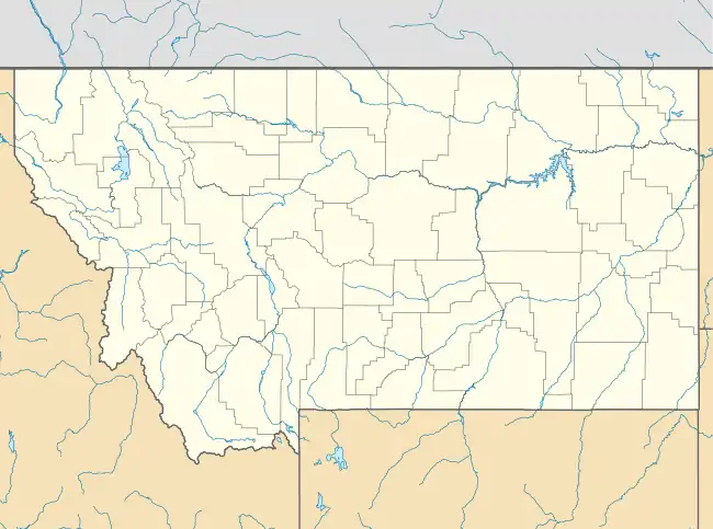 Santa Rita Location of Santa Rita, Montana  Santa Rita Santa Rita (the United States) | |
| Coordinates: 48°41′52″N 112°19′2″W / 48.69778°N 112.31722°W | |
| Country | United States |
| State | Montana |
| County | Glacier |
| Area | |
| • Total | 3.46 sq mi (8.97 km2) |
| • Land | 3.46 sq mi (8.97 km2) |
| • Water | 0.00 sq mi (0.00 km2) |
| Elevation | 3,793 ft (1,156 m) |
| Population (2020) | |
| • Total | 107 |
| • Density | 30.90/sq mi (11.93/km2) |
| Time zone | UTC-7 (Mountain (MST)) |
| • Summer (DST) | UTC-6 (MDT) |
| Area code | 406 |
| FIPS code | 30-66250 |
| GNIS feature ID | 2583843[2] |
Santa Rita is a census-designated place (CDP) in Glacier County, Montana, United States. The population was 107 at the 2020 census.[3] It is located along Montana Secondary Highway 213, 5 miles north of Cut Bank.
Demographics
| Census | Pop. | Note | %± |
|---|---|---|---|
| 2020 | 107 | — | |
| U.S. Decennial Census[4] | |||
Climate
According to the Köppen Climate Classification system, Santa Rita has a semi-arid climate, abbreviated "BSk" on climate maps.[3]
References
- ↑ "ArcGIS REST Services Directory". United States Census Bureau. Retrieved September 5, 2022.
- ↑ U.S. Geological Survey Geographic Names Information System: Santa Rita, Montana
- 1 2 https://www.census.gov/search-results.html?searchType=web&cssp=SERP&q=Santa%20Rita%20CDP,%20Montana
- ↑ "Census of Population and Housing". Census.gov. Retrieved June 4, 2016.
Municipalities and communities of Glacier County, Montana, United States | ||
|---|---|---|
| City | 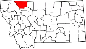 Glacier County map | |
| Town | ||
| CDPs | ||
| Indian reservation | ||
| Footnotes | ‡This populated place also has portions in an adjacent county or counties | |
This article is issued from Wikipedia. The text is licensed under Creative Commons - Attribution - Sharealike. Additional terms may apply for the media files.