Highway 364 | ||||
|---|---|---|---|---|
| Route information | ||||
| Maintained by Ministry of Highways and Infrastructure | ||||
| Length | 37.3 km[1] (23.2 mi) | |||
| Major junctions | ||||
| South end | ||||
| East end | ||||
| Location | ||||
| Country | Canada | |||
| Province | Saskatchewan | |||
| Rural municipalities | Edenwold, South Qu'Appelle | |||
| Highway system | ||||
|
| ||||
| ||||
Highway 364 is a provincial highway in the Canadian province of Saskatchewan. It runs from Highways 1 and 46 near Balgonie to Highway 10 near Edgeley. It is about 37 kilometres (23 mi) long.[1]
Highway 364 intersects Highway 734 and Highway 640. It passes by the communities of Edenwold and Avonhurst.

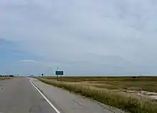
Sk Hwy 364 Edgely Edewold road sign on the Sk Hwy 10 Saskatchewan
Major intersections
From west to east:[2]
| Rural municipality | Location | km[1] | mi | Destinations | Notes |
|---|---|---|---|---|---|
| Edenwold No. 158 | Balgonie | 0.0 | 0.0 | Southern terminus; Hwy 364 travels north | |
| | 11.0 | 6.8 | |||
| Edenwold | 17.5 | 10.9 | Hwy 364 branches east; directional signage changes | ||
| South Qu'Appelle No. 157 | Avonhurst | 27.3 | 17.0 | Range Road 2162 | |
| Edgeley | 37.3 | 23.2 | Eastern terminus | ||
| 1.000 mi = 1.609 km; 1.000 km = 0.621 mi | |||||
See also
References
- 1 2 3 Google (21 February 2018). "Highway 364 in Saskatchewan" (Map). Google Maps. Google. Retrieved 21 February 2018.
- ↑ MapArt (2007). Saskatchewan Road Atlas (Map) (2007 ed.). 1:540,000. Oshawa, ON: Peter Heiler Ltd. p. 42. ISBN 1-55368-020-0.
This article is issued from Wikipedia. The text is licensed under Creative Commons - Attribution - Sharealike. Additional terms may apply for the media files.
.svg.png.webp)