Shahin Dezh County
Persian: شهرستان شاهیندژ | |
|---|---|
County | |
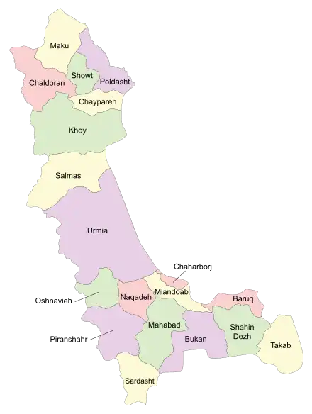 Location of Shahin Dezh County in West Azerbaijan province (bottom right, green) | |
 Location of West Azerbaijan province in Iran | |
| Coordinates: 36°39′N 46°35′E / 36.650°N 46.583°E[1] | |
| Country | |
| Province | West Azerbaijan |
| Capital | Shahin Dezh |
| Districts | Central, Keshavarz |
| Population (2016)[2] | |
| • Total | 92,456 |
| Time zone | UTC+3:30 (IRST) |
| Shahin Dezh County can be found at GEOnet Names Server, at this link, by opening the Advanced Search box, entering "9205912" in the "Unique Feature Id" form, and clicking on "Search Database". | |
Shahin Dezh County (Persian: شهرستان شاهیندژ; South Azerbaijani: صائین قالا بؤلگهسی) is in West Azerbaijan province, Iran. Its capital is the city of Shahin Dezh.[3]
At the 2006 census, the county's population was 89,356 in 20,911 households.[4] The following census in 2011 counted 91,113 people in 24,572 households.[5] At the 2016 census, the county's population was 92,456 in 27,669 households.[2] About 70% of the population of the county are Shia Azerbaijanis and 30% are Sunni Kurds.[6]
Administrative divisions
The population history of Shahin Dezh County's administrative divisions over three consecutive censuses is shown in the following table. The latest census shows two districts, five rural districts, and three cities.[2]
| Administrative Divisions | 2006[4] | 2011[5] | 2016[2] |
|---|---|---|---|
| Central District | 68,286 | 71,081 | 73,179 |
| Hulasu RD | 12,396 | 10,606 | 9,182 |
| Mahmudabad RD | 7,899 | 8,220 | 7,755 |
| Safa Khaneh RD | 7,970 | 7,179 | 6,245 |
| Mahmudabad (city) | 5,817 | 6,680 | 6,866 |
| Shahin Dezh (city) | 34,204 | 38,396 | 43,131 |
| Keshavarz District | 21,070 | 20,032 | 19,277 |
| Chaharduli RD | 6,353 | 5,470 | 4,986 |
| Keshavarz RD | 11,179 | 10,658 | 10,153 |
| Keshavarz (city) | 3,538 | 3,904 | 4,138 |
| Total | 89,356 | 91,113 | 92,456 |
| RD: Rural District | |||
Wikimedia Commons has media related to Shahin Dezh County.
References
- ↑ OpenStreetMap contributors (6 April 2023). "Shahin Dezh County" (Map). OpenStreetMap. Retrieved 6 April 2023.
- 1 2 3 4 "Census of the Islamic Republic of Iran, 1395 (2016)". AMAR (in Persian). The Statistical Center of Iran. p. 04. Archived from the original (Excel) on 30 August 2022. Retrieved 19 December 2022.
- ↑ Habibi, Hassan (24 September 1369). "Creation and establishment of two cities and several districts and annexation of several villages to Urmia city". Research Center of the System of Laws of the Islamic Council of the Farabi Library of Mobile Users (in Persian). Ministry of Interior, Defense Political Commission of the Government Board. Archived from the original on 23 February 2014. Retrieved 20 December 2023.
- 1 2 "Census of the Islamic Republic of Iran, 1385 (2006)". AMAR (in Persian). The Statistical Center of Iran. p. 04. Archived from the original (Excel) on 20 September 2011. Retrieved 25 September 2022.
- 1 2 "Census of the Islamic Republic of Iran, 1390 (2011)". Syracuse University (in Persian). The Statistical Center of Iran. p. 04. Archived from the original (Excel) on 20 January 2023. Retrieved 19 December 2022.
- ↑ Mashhad Ferdowsi University: تأثیر هویت مکانی بر توزیع فضایی رأی در حوزه انتخابیه میاندوآب، شاهیندژ و تکاب: در شهرستان شاهین دژ نسبت ترکیب جمعیت کرد ۳۰٪ و ترک ۷۰٪ و این ترکیب جمعیت در شهرستان تکاب ۳۵٪ به ۶۵٪ است.
West Azerbaijan province, Iran | ||
|---|---|---|
| Capital |  | |
| Counties and cities | ||
| Tourism | ||
| Places | ||
This article is issued from Wikipedia. The text is licensed under Creative Commons - Attribution - Sharealike. Additional terms may apply for the media files.