Shikarpur District
ضلع شكارپور شڪارپور ضلعو | |
|---|---|
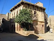
 Shrine in Nim Shareef | |
 | |
| Coordinates: 28°00′N 68°40′E / 28.000°N 68.667°E | |
| Country | |
| Province | |
| Division | Larkana |
| Established | 1977 |
| Founded by | Sindh Government |
| Headquarters | Shikarpur |
| Government | |
| • Type | District Administration |
| • Deputy Commissioner | N/A |
| • District Police Officer | N/A |
| • District Health Officer | N/A |
| Area | |
| • Total | 2,512 km2 (970 sq mi) |
| Population | |
| • Total | 1,386,330 |
| • Density | 550/km2 (1,400/sq mi) |
| Time zone | UTC+5 (PST) |
| Website | Shikarpur Sindh www.shikarpur.tk |
Shikarpur district (Sindhi: شڪارپور ضلعو, Urdu: ضلع شكارپور), is a district in Sindh province in Pakistan. The city of Shikarpur is the district headquarters. There are 4 talukas: Lakhi Ghulam Shah, Garhi Yasin, Khanpur and Shikarpur itself. It is spread over an area of 2,512 km2.[2]
Geography
Shikarpur district borders Larkana, Jacobabad, Khairpur and Sukkur. Two National Highways (N-65 & N-55) intersect the city of Shikarpur making it the junction points of 4 provinces.
Administrative divisions
The district of Shikarpur is sub-divided into four Tehsils these are:[3]
- Garhi Yasin
- Khanpur
- Lakhi
- Shikarpur
Demographics
| Year | Pop. | ±% p.a. |
|---|---|---|
| 1951 | 306,007 | — |
| 1961 | 314,780 | +0.28% |
| 1972 | 530,551 | +4.86% |
| 1981 | 596,409 | +1.31% |
| 1998 | 880,438 | +2.32% |
| 2017 | 1,233,760 | +1.79% |
| 2023 | 1,386,330 | +1.96% |
| source:[4] | ||
At the time of the 2017 census, Shikarpur district had 182,946 households and a population of 1,233,760. Shikarpur had a sex ratio of 941 females per 1000 males and a literacy rate of 40.48%: 51.65% for males and 28.79% for females. 304,441 (24.68%) lived in urban areas. 428,885 (34.76%) were under 10 years of age.[1] In 2023, the district had 214,901 households and a population of 1,386,330.[5]
| Religion | Population (1941)[6]: 54–57 | Percentage (1941) | Population (2017)[1] | Percentage (2017) |
|---|---|---|---|---|
| Islam |
167,163 | 72.27% | 1,215,158 | 98.49% |
| Hinduism |
63,276 | 27.36% | 17,246 | 1.40% |
| Others [lower-alpha 2] | 868 | 0.37% | 1,356 | 0.11% |
| Total Population | 231,307 | 100% | 1,233,760 | 100% |
The majority religion is Islam, with 98.39% of the population. Hinduism (including those from Scheduled Castes) is practiced by 1.40% of the population.[1]
At the time of the 2017 census, 92.52% of the population spoke Sindhi, 3.39% Brahui, 1.30% Balochi and 1.22% Urdu as their first language.[1]
References
- 1 2 3 4 5 6 "District Wise Results / Tables (Census - 2017)". www.pbscensus.gov.pk. Pakistan Bureau of Statistics.
- ↑ "Population of District Shikarpur Census 2017 Information 2022". www.pakinformation.com. Retrieved 2022-02-15.
- ↑ DISTRICT GOVERNMENT Shikarpur
- ↑ "Population of administrative units" (PDF). pbs.gov.pk. Pakistan Bureau of Statistics. 1998.
- ↑ "TABLE 1 : HOUSEHOLDS, POPULATION, HOUSEHOLD SIZE AND ANNUAL GROWTH RATE" (PDF). www.pbscensus.gov.pk. Pakistan Bureau of Statistics. 2023.
- ↑ "CENSUS OF INDIA, 1941 VOLUME XII SINDH PROVINCE".
Notes
- ↑ Garbi Yasin and Shikarpur taluks of Sukkur district
- ↑ Including Jainism, Christianity, Buddhism, Zoroastrianism, Judaism, Ad-Dharmis, or not stated
Bibliography
- 1998 District census report of Shikarpur. Census publication. Vol. 13. Islamabad: Population Census Organization, Statistics Division, Government of Pakistan. 1999.
Provincial capital: Karachi | ||
| Banbhore |  | |
| Hyderabad | ||
| Karachi | ||
| Larkana | ||
| Mirpur Khas | ||
| Sukkur | ||
| Shaheed Benazir Abad | ||