Shintomi
新富町 | |
|---|---|
 Shintomi Town Office | |
 Flag  Chapter | |
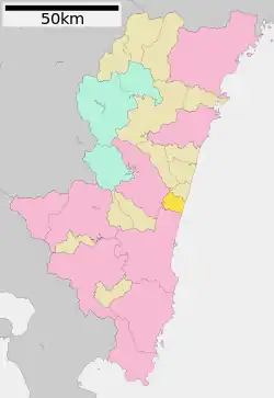
Location of Shintomi in Miyazaki Prefecture | |
 | |
 Shintomi Location in Japan | |
| Coordinates: 32°4′08″N 131°29′17″E / 32.06889°N 131.48806°E | |
| Country | Japan |
| Region | Kyushu |
| Prefecture | Miyazaki |
| District | Koyu |
| Area | |
| • Total | 61.53 km2 (23.76 sq mi) |
| Population (October 1, 2023) | |
| • Total | 16,117 |
| • Density | 260/km2 (680/sq mi) |
| Time zone | UTC+09:00 (JST) |
| City hall address | 7491 Kamitonda, Shintomi-cho, Koyu-gun, Miyazaki-ken 889-1493 |
| Website | Official website |
| Symbols | |
| Flower | Lupinus |
| Tree | Prunus mume |
Shintomi (新富町, Shintomi-chō) is a town located in Koyu District, Miyazaki Prefecture, Japan. As of 1 October 2023, the town had an estimated population of 16,117 in 6593 households, and a population density of 260 persons per km². [1] The total area of the town is 61.53 square kilometres (23.76 sq mi).
Geography
Shintomi is located in central Miyazaki Prefecture, bordered by the Hyūga Sea to the east.The town is generally flat, with plains on the sides and south, and a plateau on the west side, and approximately 70% of the town area is flat. The Hitotsuse River flows through the south of the town.
Neighbouring municipalities
Miyazaki Prefecture
Climate
Shintomi has a humid subtropical climate (Köppen Cfa) characterized by warm summers and cool winters with light to no snowfall. The average annual temperature in Shintomi is 16.4 °C. The average annual rainfall is 2216 mm with September as the wettest month. The temperatures are highest on average in August, at around 26.1 °C, and lowest in January, at around 6.5 °C.[2]
Demographics
Per Japanese census data, the population of Shintomi is as shown below
| Year | Pop. | ±% |
|---|---|---|
| 1950 | 12,106 | — |
| 1960 | 16,463 | +36.0% |
| 1970 | 17,123 | +4.0% |
| 1980 | 16,514 | −3.6% |
| 1990 | 17,220 | +4.3% |
| 2000 | 18,085 | +5.0% |
| 2010 | 19,058 | +5.4% |
| 2020 | 18,094 | −5.1% |
History
The area of Shintomi was part of ancient Hyūga Province. Duirng teh Edo period, the area was largely part of the holdings of Sadowara Domain. The villages of Tonda and Nyūta within Koyu District, Miyazaki was established on April 1, 1889 with the creation of the modern municipalities system. The villages merged on March 31, 1959 to form the town of Shintomi.
Government
Shintomi has a mayor-council form of government with a directly elected mayor and a unicameral town council of 12 members. Shinomi, collectively with the other municipalities of Koyu District contributes three members to the Miyazaki Prefectural Assembly. In terms of national politics, the town is part of the Miyazaki 2nd district of the lower house of the Diet of Japan. The town is the location of the JASDF Nyutabaru Air Base.
Economy
The main industry of Shintomi is agriculture. Bell peppers, tomatoes, cymbidium, and cucumbers are cultivated. In the mountain areas, chickens and other livestock are raised.
Education
Shintomi has two public elementary schools and one public junior high school operated by the town government and one public high school operated by the Miyazaki Prefectural Board of Education. The prefecture also operates one special education school for the handicapped. In Shintomi, all of the windows in the schools are double-paned to block noise from a nearby military base.
Transportation
Railways
Highways
Local attractions
- Nyūtabaru Kofun Cluster, National Historic Site
References
- ↑ "Shintomi Town official statistics" (in Japanese). Japan.
- ↑ Shintomi climate: Average Temperature, weather by month
External links
 Media related to Shintomi, Miyazaki at Wikimedia Commons
- Shintomi official website (in Japanese)