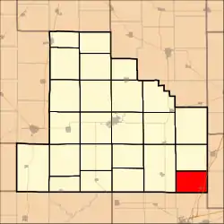
Sigel Township | |
|---|---|
 | |
.svg.png.webp) Location of Illinois in the United States | |
| Coordinates: 39°15′05″N 88°31′28″W / 39.25139°N 88.52444°W | |
| Country | United States |
| State | Illinois |
| County | Shelby |
| Organized | Unknown |
| Area | |
| • Total | 23.83 sq mi (61.7 km2) |
| • Land | 23.82 sq mi (61.7 km2) |
| • Water | 0.01 sq mi (0.03 km2) |
| Elevation | 630 ft (190 m) |
| Population (2010) | |
| • Estimate (2016)[1] | 805 |
| • Density | 34.7/sq mi (13.4/km2) |
| Time zone | UTC-6 (CST) |
| • Summer (DST) | UTC-5 (CDT) |
| ZIP code | 62462 |
| Area code | 217 |
| FIPS code | 17-173-69927 |
Geography
According to the 2010 census, the township has a total area of 23.83 square miles (61.7 km2), of which 23.82 square miles (61.7 km2) (or 99.96%) is land and 0.01 square miles (0.026 km2) (or 0.04%) is water.[2]
Demographics
| Census | Pop. | Note | %± |
|---|---|---|---|
| 2016 (est.) | 805 | [1] | |
| U.S. Decennial Census[3] | |||
References
- 1 2 "Population and Housing Unit Estimates". Retrieved June 9, 2017.
- ↑ "Population, Housing Units, Area, and Density: 2010 - County -- County Subdivision and Place -- 2010 Census Summary File 1". United States Census. Archived from the original on February 12, 2020. Retrieved May 28, 2013.
- ↑ "Census of Population and Housing". Census.gov. Retrieved June 4, 2016.
External links
Municipalities and communities of Shelby County, Illinois, United States | ||
|---|---|---|
| Cities | Map of Illinois highlighting Shelby County | |
| Towns | ||
| Villages | ||
| Townships | ||
| CDPs | ||
| Other communities | ||
| Footnotes | ‡This populated place also has portions in an adjacent county or counties | |
This article is issued from Wikipedia. The text is licensed under Creative Commons - Attribution - Sharealike. Additional terms may apply for the media files.