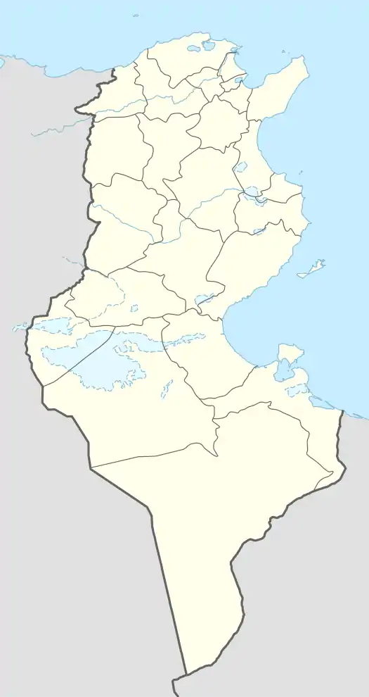
36°30′N 8°47′E / 36.500°N 8.783°E
Jendouba
جندوبة | |
|---|---|
 | |
 Jendouba | |
| Coordinates: 36°29′N 08°47′E / 36.483°N 8.783°E | |
| Country | |
| Governorate | Jendouba Governorate |
| Delegation(s) | Jendouba South, Jendouba Nord |
| Government | |
| • Mayor | Amar Ayadi (Ennahda) |
| Elevation | 143 m (469 ft) |
| Population (2014) | |
| • Total | 46,459 |
| Time zone | UTC+1 (CET) |
| • Summer (DST) | UTC+2 (CEST) |
| Website | commune-jendouba.gov.tn |
Jendouba (Arabic: جندوبة ; Formerly known as Souk El Arba until 30 April 1966) is a city in northwestern Tunisia, and capital of the Jendouba Governorate. It is an important crossroads with many road links to other towns such as El Kef, Tabarka, Ain Draham and Béja. The main economic activity is agriculture. It is close to the famous ancient Roman city of Bullaregia or Bulla Regia, as well as the ancient marble quarry of Chemtou. The city's name is derived from Amazigh with the exact translation being “land of grain.”
History
Historically, this region was important and wealthy.
During the Roman Empire the town was called Libertina and was a civitas of the Roman Province of Byzacena in North Africa. The historical importance of the area is evidenced by the nearby great Roman cities of Bulla Regia and Chemtou. Several other historical sites witness the role this city played centuries ago in the economic life of the region.
Around 670 the town fell to the Muslim conquest of the Maghreb.
Under the French, Jendouba Ville is remembered as the Tunisian area where the civil demand for independence from French colonization started on April 9, 1934. The protests started in the town of Oued Meliz on April 4, 1934, before arriving in the capital and becoming a national movement.
The "events of April 9, 1938 " ( 9 أحداث أفريل 1938) were street protests demanding political reforms, including the establishment of a parliament, a major step towards the independence of Tunisia whilst a French protectorate. They resulted in a bloody shootout that marked the start of the Tunisian national movement.
During World War II there was an airfield outside the village. During Operation Torch, the town and was captured by paratroops of the British 1st Parachute Brigade on 16 November 1942.[1]
It is also the birthplace of former Dallas Mavericks center Salah Mejri.
Climate
Jendouba has a hot semi-arid climate (Köppen climate classification BSh). In winter there is much more rainfall than in summer. The average annual temperature in Jendouba is 18.2 °C (64.8 °F). About 470 mm (18.50 in) of precipitation falls annually.
| Climate data for Jendouba (1981–2010, extremes 1950–2021) | |||||||||||||
|---|---|---|---|---|---|---|---|---|---|---|---|---|---|
| Month | Jan | Feb | Mar | Apr | May | Jun | Jul | Aug | Sep | Oct | Nov | Dec | Year |
| Record high °C (°F) | 28.8 (83.8) |
28.8 (83.8) |
36.2 (97.2) |
36.4 (97.5) |
44.1 (111.4) |
47.6 (117.7) |
48.5 (119.3) |
49.0 (120.2) |
44.1 (111.4) |
41.4 (106.5) |
32.0 (89.6) |
29.4 (84.9) |
49.0 (120.2) |
| Mean daily maximum °C (°F) | 15.3 (59.5) |
16.4 (61.5) |
19.1 (66.4) |
22.3 (72.1) |
28.0 (82.4) |
33.2 (91.8) |
36.8 (98.2) |
36.7 (98.1) |
32.0 (89.6) |
27.1 (80.8) |
20.7 (69.3) |
16.6 (61.9) |
25.4 (77.6) |
| Daily mean °C (°F) | 9.6 (49.3) |
10.4 (50.7) |
12.5 (54.5) |
15.3 (59.5) |
20.1 (68.2) |
24.8 (76.6) |
28.1 (82.6) |
28.2 (82.8) |
24.4 (75.9) |
20.0 (68.0) |
14.5 (58.1) |
11.0 (51.8) |
18.2 (64.8) |
| Mean daily minimum °C (°F) | 4.9 (40.8) |
5.0 (41.0) |
6.4 (43.5) |
8.4 (47.1) |
12.3 (54.1) |
16.5 (61.7) |
19.4 (66.9) |
20.1 (68.2) |
17.7 (63.9) |
13.8 (56.8) |
9.4 (48.9) |
6.1 (43.0) |
11.7 (53.0) |
| Record low °C (°F) | −4.3 (24.3) |
−4.0 (24.8) |
−5.2 (22.6) |
−0.3 (31.5) |
3.0 (37.4) |
5.6 (42.1) |
9.8 (49.6) |
11.2 (52.2) |
8.0 (46.4) |
3.5 (38.3) |
−0.7 (30.7) |
−4.0 (24.8) |
−5.2 (22.6) |
| Average precipitation mm (inches) | 65.7 (2.59) |
49.7 (1.96) |
49.9 (1.96) |
42.9 (1.69) |
33.1 (1.30) |
17.1 (0.67) |
6.2 (0.24) |
11.6 (0.46) |
36.2 (1.43) |
40.6 (1.60) |
52.8 (2.08) |
64.7 (2.55) |
470.5 (18.53) |
| Average precipitation days (≥ 1.0 mm) | 8.7 | 7.8 | 8.2 | 6.3 | 4.1 | 2.5 | 0.9 | 1.9 | 3.8 | 5.6 | 5.7 | 8.0 | 63.5 |
| Average relative humidity (%) | 77 | 75 | 74 | 72 | 66 | 59 | 52 | 54 | 61 | 69 | 75 | 78 | 68 |
| Mean monthly sunshine hours | 142.6 | 154.0 | 192.2 | 219.0 | 272.8 | 306.0 | 347.2 | 316.2 | 258.0 | 207.7 | 168.0 | 148.8 | 2,732.5 |
| Source: Institut National de la Météorologie (precipitation days/humidity/sun 1961–1990)[2][3][4][note 1] | |||||||||||||
References
- ↑ Kurowski, F. (1982) Endkampf in Afrika, Leoni-am-Starnberger See:Druffel-Verlag, p.54. ISBN 3806110247 (German language).
- ↑ "Les normales climatiques en Tunisie entre 1981 2010" (in French). Ministère du Transport. Archived from the original on 19 December 2019. Retrieved 25 January 2020.
- ↑ "Données normales climatiques 1961-1990" (in French). Ministère du Transport. Archived from the original on 21 December 2019. Retrieved 25 January 2020.
- ↑ "Les extrêmes climatiques en Tunisie" (in French). Ministère du Transport. Archived from the original on 21 December 2019. Retrieved 25 January 2020.
- ↑ "Réseau des stations météorologiques synoptiques de la Tunisie" (in French). Ministère du Transport. Retrieved 25 January 2020.
Notes