| Staythorpe | |
|---|---|
| Civil parish | |
 Former water pumping station for cooling turbines at Staythorpe Power Station | |
Parish map | |
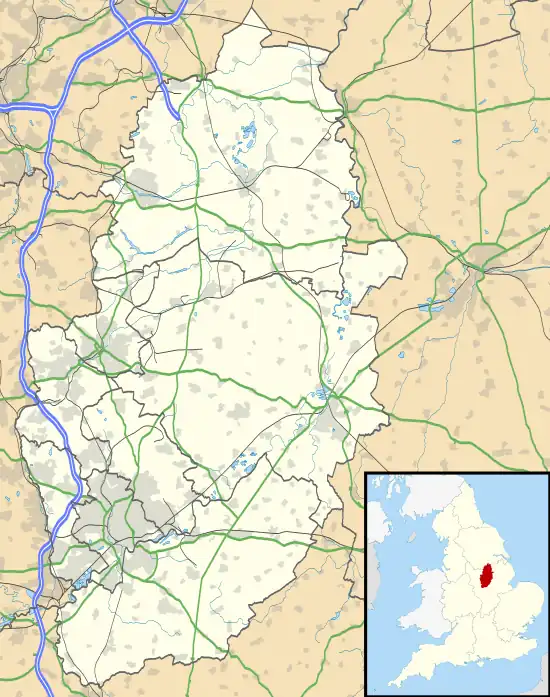
 Staythorpe Location within Nottinghamshire | |
| Area | 2.67 km2 (1.03 sq mi) |
| Population | 93 [1] |
| • Density | 35/km2 (91/sq mi) |
| OS grid reference | SK 75351 53961 |
| District | |
| Shire county | |
| Region | |
| Country | England |
| Sovereign state | United Kingdom |
| Post town | NEWARK |
| Postcode district | NG23 |
| Dialling code | 01636 |
| Police | Nottinghamshire |
| Fire | Nottinghamshire |
| Ambulance | East Midlands |
| UK Parliament | |
| Website | www |
Staythorpe is a hamlet and civil parish in the Newark and Sherwood district of Nottinghamshire, England. During the 2021 census, the population was recorded as 93 residents.[1]
Geography
The settlement is situated 3 miles west of Newark-on-Trent, and lies alongside the banks of the River Trent. The village is primarily rural in nature with much farmland, but very little in way of amenities.
Staythorpe's neighbours include
Rundell and Pingley Dykes are 2 streams which run through the parish.
The land is very low-lying and level, varying little in elevation between 12–14 metres (39–46 ft) throughout.
Communities
There are three distinct residential areas in Staythorpe parish:
- The historic village area by Pingley Lane
- Behay Gardens
- The Hughs Close gated community alongside the Nottingham to Lincoln railway level crossing.
Governance and demographics
The population of Staythorpe as recorded for the 2021 UK census is 93 residents.[1] Averham, nearby Kelham and Staythorpe, although each are parished, they are grouped together to form a parish council for administrative efficiency due to their small populations.[2]
Economy
Other than farming, electricity generation and distribution are the only large scale local industries:
- Staythorpe Power Station is located by the riverside and owned by RWE
- There is a large substation operated by the National Grid.
History
Toponymy
Staythorpe was listed in the Domesday Book in 1086, it was then called Startorp, meaning 'Stari 's village,'.[3][4]
Heritage
Staythorpe recorded twelve villagers at the time of the Domesday Survey,[5] the core settlement was for centuries based around Pingley Lane, which branched off the Nottingham-Newark route. In medieval times it belonged to the monastery of Newstead, but when King Henry VIII renounced the Catholic Church and dissolved the monasteries, he gave the land to Trinity College, Cambridge.[6] For centuries it was a township in Averham parish.[7] During WWII, an aircraft crashed east of the village.[8][9] In 1946 a large area of riverside land was sold to the Derbyshire & Nottinghamshire Electric Power Company, the building of Staythorpe Power Station was begun and the first turbine unit was put into service in March 1950. Thirteen cottages were built for the managers and chemists of the new plant in 1947, which greatly increased the size of the village.[10]
The housing development was commissioned by its successor British Electricity Authority, the initials (BEA) phonetically forming the name of the estate Behay Gardens. The cottages were designed by local architect Thomas Cecil Howitt, OBE, who was a British provincial architect of the 20th century and is chiefly remembered for designing prominent public buildings, such as the Council House and Processional Way in Nottingham.[10] A larger power station, Staythorpe B was built alongside the first, construction commenced in 1956 and was officially opened in May 1962. The first or 'A' station was decommissioned in 1983 and demolition was started in 1986 and finished in 1988. Staythorpe B closed in 1994. Staythorpe C opened in 2010.[11] The Hughs Close estate was built in the middle 1990s,[12] and was the only new development in the parish after Behay Gardens, which has since been sold off to the general public.[13]
Landmarks
The long distance Trent Valley Way walking path passes through the parish and follows the River Trent.
There is one listed building, the Manor House based in the core village area and is designated at Grade II. It dates from the end of the 18th century.[14]
Transport
The Nottingham to Lincoln railway line passes through the parish west to east. However, the nearest stop is 1 mile south west at Rolleston railway station.
References
- 1 2 3 UK Census (2021). "2021 Census Area Profile – Staythorpe (E04007936)". Nomis. Office for National Statistics. Retrieved 8 January 2024.
- ↑ "Averham, Kelham and Staythorpe Parish Council, Averham, Newark". www.akspc.org.uk. Retrieved 1 November 2020.
- ↑ "Starthorpe | British History Online". www.british-history.ac.uk. Retrieved 1 November 2020.
- ↑ "Staythorpe :: Survey of English Place-Names". epns.nottingham.ac.uk. Retrieved 24 November 2020.
- ↑ "Staythorpe | Domesday Book". opendomesday.org. Retrieved 8 January 2024.
- ↑ "Staythorpe, Nottinghamshire - genealogy heraldry and history". ukga.org. Retrieved 1 November 2020.
- ↑ "Averham with Kelham, Nottinghamshire Family History Guide - Parishmouse". 8 November 2023. Retrieved 8 January 2024.
- ↑ "M18118 - WWII AIRCRAFT CRASH SITE AT STAYTHORPE - Nottinghamshire Historic Environment Record". her.nottinghamshire.gov.uk. Retrieved 8 January 2024.
- ↑ "STAYTHORPE BATTERY ENERGY STORAGE SYSTEM HERITAGE IMPACT ASSESSMENT" (PDF). September 2022.
- 1 2 "Behay Gardens Sign". The Plough, Averham, Kelham and Staythorpe Community and Parish Magazine: 10. February 2022.
- ↑ "Staythorpe Power Stations - Graces Guide". www.gracesguide.co.uk. Retrieved 24 November 2020.
- ↑ "Planning application".
- ↑ "Towns and Villages Around Newark-on-Trent | Staythorpe". www.visitoruk.com. Retrieved 1 November 2020.
- ↑ "THE MANOR HOUSE, Staythorpe - 1370184 | Historic England". historicengland.org.uk. Retrieved 25 November 2020.