| Surabaya-Gresik Toll Road | |
|---|---|
 | |
| Route information | |
| Part of | |
| Maintained by PT Margabumi Matraraya | |
| Length | 21 km (13 mi) |
| Major junctions | |
| East end | Dupak Interchange |
| West end | Manyar |
| Location | |
| Country | Indonesia |
| Major cities | |
| Highway system | |
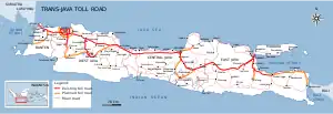
Surabaya–Gresik Toll Road is a toll road in Indonesia, located between Surabaya and Gresik in the island of Java. The highway is 21 kilometers long. The highway acts as a complement for Trans-Java Expressway.
Description
The highway starts on a cloverleaf with the Surabaya–Gempol Toll Road, and leads westward with 2x2 lanes, and crosses industrial sites west of Surabaya. The motorway then forms a large bypass of the port city of Gresik, which serves the motorway with two non-level connections. Then the highway ends with a crossroads north of Gresik on a main road that goes further west along the coast.[1]
Exits
| Province | Location | km | mi | Exit | Name | Destinations | Notes |
|---|---|---|---|---|---|---|---|
| East Java | Asemrowo, Surabaya | 0.0 | 0.0 | 0 | Dupak Interchange |
| Eastern terminus |
| 2.8 | 1.7 | 3 | Tandes Timur Toll Gate |
| |||
| 3.6 | 2.2 | Tandes Barat Toll Gate | |||||
| Benowo, Surabaya | 8.6 | 5.3 | 8 | Romokalisari Junction |
| Tambak Osowilangun gate is currently under construction | |
| Kebomas, Gresik Regency | 16.3 | 10.1 | 16 | Kebomas Interchange | |||
| Manyar, Gresik Regency | 20.1 | 12.5 | Manyar Toll Gate | ||||
1.000 mi = 1.609 km; 1.000 km = 0.621 mi
| |||||||
References
- ↑ "Govt to raise Surabaya-Gresik toll-road fare". The Jakarta Post. Retrieved 19 December 2017.
This article is issued from Wikipedia. The text is licensed under Creative Commons - Attribution - Sharealike. Additional terms may apply for the media files.