Susuman
Сусуман | |
|---|---|
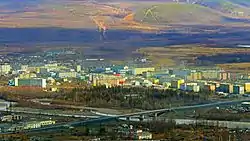
 View of central Susuman and the Byoryolyokh River | |
.svg.png.webp) Flag .png.webp) Coat of arms | |
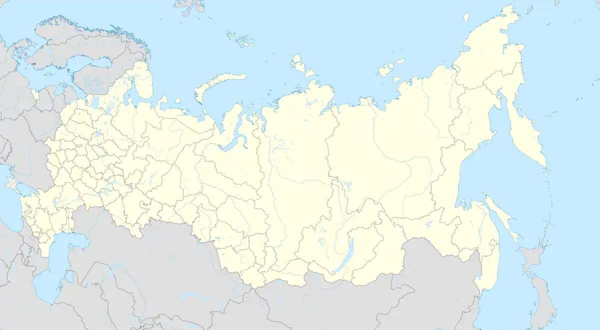
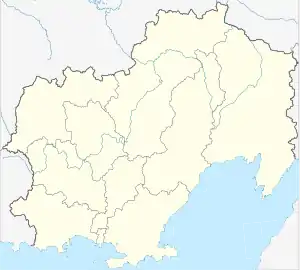
Location of Susuman | |
 Susuman Location of Susuman  Susuman Susuman (Magadan Oblast) | |
| Coordinates: 62°47′N 148°10′E / 62.783°N 148.167°E | |
| Country | Russia |
| Federal subject | Magadan Oblast[1] |
| Administrative district | Susumansky District[1] |
| Founded | 1936 |
| Town status since | 1964 |
| Elevation | 650 m (2,130 ft) |
| Population | |
| • Total | 5,855 |
| • Estimate (2018)[3] | 4,760 (−18.7%) |
| • Capital of | Susumansky District[1] |
| • Municipal district | Susumansky Municipal District[4] |
| • Urban settlement | Susuman Urban Settlement[4] |
| • Capital of | Susumansky Municipal District,[5] Susuman Urban Settlement[4] |
| Time zone | UTC+11 (MSK+8 |
| Postal code(s)[7] | 686314 |
| Dialing code(s) | +7 41345 |
| OKTMO ID | 44713000001 |
| Website | www |
Susuman (Russian: Сусума́н) is a town and the administrative center of Susumansky District in Magadan Oblast, Russia, located on the Byoryolyokh River, 650 kilometers (400 mi) northwest of Magadan, the administrative center of the oblast. Population: 4,439 (2021 Census);[8] 5,855 (2010 Census);[2] 7,833 (2002 Census);[9] 16,818 (1989 Census).[10]
Geography
The town lies in the Upper Kolyma region near where the Susuman River joins the Byoryolyokh.[11] The town sits on the M56 Kolyma Highway, an unsealed track often known as the "Road of Bones", which connects Yakutsk with Magadan.
History
It was founded in 1936 as a settlement of a sovkhoz called Susuman, named after the nearby river of the same name. In 1938, the settlement was greatly expanded to become a center of gold mining in the western part of what is now Magadan Oblast under the control of Dalstroy.
Gold mining and other industrial operations in the region were largely reliant on corrective labor camps of the Gulag system, with a large number operating in Susuman's vicinity. From 1949 until 1956, Susuman was the base for one of the Soviet Union's largest corrective labor camps, the Zaplag of the Dalstroy program. During this time, up to 16,500 prisoners were kept in the camps.
Susuman was granted town status in 1964. In the post-Soviet period, the population dropped significantly, from a high of around 18,000 inhabitants in 1991, down to 5,855 as of the 2010 Census.
Climate
Susuman has an extreme dry-winter subarctic climate (Köppen climate classification Dwd/Dwc) with extremely cold, dry winters and short, very mild summers. It is one of the coldest permanently inhabited settlements in the world, with yearly mean temperature of −11.5 °C (11.3 °F)
| Climate data for Susuman (1991-2020) | |||||||||||||
|---|---|---|---|---|---|---|---|---|---|---|---|---|---|
| Month | Jan | Feb | Mar | Apr | May | Jun | Jul | Aug | Sep | Oct | Nov | Dec | Year |
| Record high °C (°F) | −4.1 (24.6) |
−1.6 (29.1) |
0.7 (33.3) |
12.1 (53.8) |
26.1 (79.0) |
33.2 (91.8) |
35.0 (95.0) |
33.0 (91.4) |
24.4 (75.9) |
11.3 (52.3) |
2.1 (35.8) |
−1.6 (29.1) |
35.0 (95.0) |
| Mean daily maximum °C (°F) | −32.9 (−27.2) |
−26.9 (−16.4) |
−15.3 (4.5) |
−3.4 (25.9) |
9.5 (49.1) |
19.7 (67.5) |
22.4 (72.3) |
18.1 (64.6) |
9.2 (48.6) |
−6.7 (19.9) |
−23.2 (−9.8) |
−32.6 (−26.7) |
−5.2 (22.7) |
| Daily mean °C (°F) | −37.4 (−35.3) |
−33.2 (−27.8) |
−23.6 (−10.5) |
−10.9 (12.4) |
3.5 (38.3) |
12.2 (54.0) |
14.9 (58.8) |
10.8 (51.4) |
2.9 (37.2) |
−12.6 (9.3) |
−27.8 (−18.0) |
−36.5 (−33.7) |
−11.5 (11.3) |
| Mean daily minimum °C (°F) | −41.5 (−42.7) |
−38.3 (−36.9) |
−31.1 (−24.0) |
−19.2 (−2.6) |
−3.1 (26.4) |
4.5 (40.1) |
7.5 (45.5) |
4.0 (39.2) |
−2.4 (27.7) |
−17.8 (0.0) |
−32.1 (−25.8) |
−40.4 (−40.7) |
−17.5 (0.5) |
| Record low °C (°F) | −60.6 (−77.1) |
−59.9 (−75.8) |
−53.7 (−64.7) |
−44 (−47) |
−27.5 (−17.5) |
−8.3 (17.1) |
−4.6 (23.7) |
−11.1 (12.0) |
−24.3 (−11.7) |
−44.7 (−48.5) |
−53.8 (−64.8) |
−58.5 (−73.3) |
−60.6 (−77.1) |
| Average precipitation mm (inches) | 9.4 (0.37) |
7.6 (0.30) |
5.4 (0.21) |
6.1 (0.24) |
14.6 (0.57) |
42.3 (1.67) |
59.0 (2.32) |
65.9 (2.59) |
34.9 (1.37) |
20.0 (0.79) |
17.0 (0.67) |
9.8 (0.39) |
292 (11.49) |
| Average precipitation days (≥ 0.1 mm) | 13.9 | 11.8 | 8.1 | 6.1 | 7.4 | 12.7 | 13.7 | 13.2 | 10.2 | 11.6 | 13.5 | 13.1 | 135.3 |
| Mean monthly sunshine hours | 20 | 89 | 213 | 283 | 273 | 291 | 274 | 223 | 152 | 132 | 53 | 10 | 2,013 |
| Source 1: climatebase.ru (1937-2012)[12] | |||||||||||||
| Source 2: pogodaiklimat.ru (temperatures)[13] | |||||||||||||
| Year | Pop. | ±% |
|---|---|---|
| 1959 | 13,310 | — |
| 1970 | 12,643 | −5.0% |
| 1979 | 16,025 | +26.7% |
| 1989 | 16,818 | +4.9% |
| 2002 | 7,833 | −53.4% |
| 2010 | 5,855 | −25.3% |
| 2021 | 4,439 | −24.2% |
| Source: Census data | ||
Administrative and municipal status
Within the framework of administrative divisions, Susuman serves as the administrative center of Susumansky District, to which it is directly subordinated.[1] As a municipal division, the town of Susuman is incorporated within Susumansky Municipal District as Susuman Urban Settlement.[4]
Economy
The town's economy relies mainly on its status as one of the centers of gold mining in the Kolyma region.
Transportation
The town is served by the Susuman Airport, with four flights a week from Magadan.
Documentary
Susuman and its nearby Dalstroy goldmine is portrayed in the prizewinning documentary on the Gulag in the far east of Siberia GOLD Lost in Siberia (VPRO/The Netherlands 1994) YouTube: [* www.imdb.com by a Dutch filmteam, led by author Gerard Jacobs and filmmaker Theo Uittenbogaard
References
Notes
- 1 2 3 4 5 Law #1292-OZ
- 1 2 Russian Federal State Statistics Service (2011). Всероссийская перепись населения 2010 года. Том 1 [2010 All-Russian Population Census, vol. 1]. Всероссийская перепись населения 2010 года [2010 All-Russia Population Census] (in Russian). Federal State Statistics Service.
- ↑ "26. Численность постоянного населения Российской Федерации по муниципальным образованиям на 1 января 2018 года". Federal State Statistics Service. Retrieved January 23, 2019.
- 1 2 3 4 Law #512-OZ
- ↑ Law #511-OZ
- ↑ "Об исчислении времени". Официальный интернет-портал правовой информации (in Russian). June 3, 2011. Retrieved January 19, 2019.
- ↑ Почта России. Информационно-вычислительный центр ОАСУ РПО. (Russian Post). Поиск объектов почтовой связи (Postal Objects Search) (in Russian)
- ↑ Russian Federal State Statistics Service. Всероссийская перепись населения 2020 года. Том 1 [2020 All-Russian Population Census, vol. 1] (XLS) (in Russian). Federal State Statistics Service.
- ↑ Russian Federal State Statistics Service (May 21, 2004). Численность населения России, субъектов Российской Федерации в составе федеральных округов, районов, городских поселений, сельских населённых пунктов – районных центров и сельских населённых пунктов с населением 3 тысячи и более человек [Population of Russia, Its Federal Districts, Federal Subjects, Districts, Urban Localities, Rural Localities—Administrative Centers, and Rural Localities with Population of Over 3,000] (XLS). Всероссийская перепись населения 2002 года [All-Russia Population Census of 2002] (in Russian).
- ↑ Всесоюзная перепись населения 1989 г. Численность наличного населения союзных и автономных республик, автономных областей и округов, краёв, областей, районов, городских поселений и сёл-райцентров [All Union Population Census of 1989: Present Population of Union and Autonomous Republics, Autonomous Oblasts and Okrugs, Krais, Oblasts, Districts, Urban Settlements, and Villages Serving as District Administrative Centers]. Всесоюзная перепись населения 1989 года [All-Union Population Census of 1989] (in Russian). Институт демографии Национального исследовательского университета: Высшая школа экономики [Institute of Demography at the National Research University: Higher School of Economics]. 1989 – via Demoscope Weekly.
- ↑ Верхнеколымское нагорье
- ↑ "climatebase.ru" (in Russian). Retrieved February 15, 2017.
- ↑ "Roshydromet" (in Russian). Retrieved February 15, 2017.
Sources
- Магаданская областная Дума. Закон №1292-ОЗ от 9 июня 2010 г. «Об административно-территориальном устройстве Магаданской области», в ред. Закона №1756-ОЗ от 9 июня 2014 г. «О внесении изменений в Закон Магаданской области "Об административно-территориальном устройстве Магаданской области"». Вступил в силу через 10 дней после дня официального опубликования. Опубликован: Приложение к газете "Магаданская правда", №63(20183), 16 июня 2010 г. (Magadan Oblast Duma. Law #1292-OZ of June 9, 2010 On the Administrative-Territorial Structure of Magadan Oblast, as amended by the Law #1756-OZ of June 9, 2014 On Amending the Law of Magadan Oblast "On the Administrative-Territorial Structure of Magadan Oblast". Effective as of the day which is 10 days after the official publication date.).
- Магаданская областная Дума. Закон №511-ОЗ от 28 декабря 2004 г. «О границах и статусе муниципальных образований в Магаданской области», в ред. Закона №1887-ОЗ от 8 апреля 2015 г. «О преобразовании муниципальных образований "посёлок Усть-Омчуг", "посёлок Омчак", "посёлок им. Гастелло", "посёлок Мадаун" путём их объединения с наделением статуса городского округа». Вступил в силу с 31 декабря 2004 г., за исключением положений, для которых установлены иные сроки вступления в силу. Опубликован: "Магаданская правда", №146 (19370), 29 декабря 2004 г. (Magadan Oblast Duma. Law #511-OZ of December 28, 2004 On the Borders and Status of the Municipal Formations in Magadan Oblast, as amended by the Law #1887-OZ of April 8, 2015 On the Transformation of the Municipal Formations of the "Settlement of Ust-Omchug", "Settlement of Omchak", "Settlement of imeni Gastello", "Settlement of Madaun" by Merging Them and Giving Them a Status of the Urban Okrug. Effective as of December 31, 2004, with the exception of clauses for which different dates of taking effect have been set.).
- Магаданская областная Дума. Закон №512-ОЗ от 28 декабря 2004 г. «О границах и статусе вновь образованных муниципальных образований в Магаданской области», в ред. Закона №1887-ОЗ от 8 апреля 2015 г. «О преобразовании муниципальных образований "посёлок Усть-Омчуг", "посёлок Омчак", "посёлок им. Гастелло", "посёлок Мадаун" путём их объединения с наделением статуса городского округа». Вступил в силу с 31 декабря 2004 г.. Опубликован: "Магаданская правда", №146 (19370), 29 декабря 2004 г. (Magadan Oblast Duma. Law #512-OZ of December 28, 2004 On the Borders and Status of the Newly Established Municipal Formations in Magadan Oblast, as amended by the Law #1887-OZ of April 8, 2015 On the Transformation of the Municipal Formations of the "Settlement of Ust-Omchug", "Settlement of Omchak", "Settlement of imeni Gastello", "Settlement of Madaun" by Merging Them and Giving Them a Status of the Urban Okrug. Effective as of December 31, 2004.).
External links
- Official website of Susuman (in Russian)
- Unofficial website of Susuman (in Russian)
- Documentary *** GOLD*** - lost in Siberia by Gerard Jacobs and Theo Uittenbogaard (VPRO/The Netherlands/1994) was filmed in the summer of 1993 in Magadan, along the Road of Bones, through Ust-Umshug and Susuman and at the Sverovostok Zoloto gold mine, Siberia, by the first foreign film crew ever, visiting the Kolyma District -which had been under control of the Soviet secret service, under the company name Dalstroj, for over 60 years.