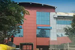
Swami Vivekananda Road (commonly referred to as SV Road) is an elevated metro station on the East-West corridor of the Purple Line of Namma Metro in Bangalore, India.[2]
Station layout
Swami Vivekananda Road track layout | ||||||||||||||||||||||||||||||||||||||||||
|---|---|---|---|---|---|---|---|---|---|---|---|---|---|---|---|---|---|---|---|---|---|---|---|---|---|---|---|---|---|---|---|---|---|---|---|---|---|---|---|---|---|---|
| ||||||||||||||||||||||||||||||||||||||||||
Station with two tracks and two side platforms | ||||||||||||||||||||||||||||||||||||||||||
| G | Street Level | Exit/Entrance |
| L1 | Mezzanine | Fare control, station agent, Metro Card vending machines, crossover |
| L2 | Side platform | Doors will open on the left | |
| Platform 1 Eastbound |
Towards → Whitefield (Kadugodi) next station is Baiyappanahalli | |
| Platform 2 Westbound |
Towards ← Challaghatta next station is Indiranagar | |
| Side platform | Doors will open on the left | ||
| L2 | ||
Entry/Exits
See also
References
- ↑ "Metro ready but how do we get to the station?". Deccan Chronicle. Retrieved 27 April 2016.
- ↑ "Bangalore Metro opens to public at 4pm on Thursday". The Hindu. 17 October 2011. Retrieved 17 October 2011.
External links
Wikimedia Commons has media related to Swami Vivekananda Road metro station.
Wikivoyage has a travel guide for Bangalore.
- Bangalore Metro Rail Corporation Ltd. (Official site)
- UrbanRail.Net – descriptions of all metro systems in the world, each with a schematic map showing all stations.
| ||
Depot(s) |
| |
See also | ||
| Biography |  | ||||||||||
|---|---|---|---|---|---|---|---|---|---|---|---|
| Works and philosophy |
| ||||||||||
| Foundations | |||||||||||
| Disciples and friends |
| ||||||||||
| Memorials |
| ||||||||||
| Depictions |
| ||||||||||
| Namesake educational institutions |
| ||||||||||
| Books about | |||||||||||
| Researchers | |||||||||||
| |||||||||||
This article is issued from Wikipedia. The text is licensed under Creative Commons - Attribution - Sharealike. Additional terms may apply for the media files.