Tavel | |
|---|---|
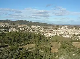 A general view of Tavel | |
.svg.png.webp) Coat of arms | |
Location of Tavel | |
 Tavel  Tavel | |
| Coordinates: 44°00′43″N 4°42′02″E / 44.0119°N 4.7006°E | |
| Country | France |
| Region | Occitania |
| Department | Gard |
| Arrondissement | Nîmes |
| Canton | Roquemaure |
| Intercommunality | CA Gard Rhodanien |
| Government | |
| • Mayor (2020–2026) | Claude Philip[1] |
| Area 1 | 19.96 km2 (7.71 sq mi) |
| Population | 2,031 |
| • Density | 100/km2 (260/sq mi) |
| Time zone | UTC+01:00 (CET) |
| • Summer (DST) | UTC+02:00 (CEST) |
| INSEE/Postal code | 30326 /30126 |
| Elevation | 50–265 m (164–869 ft) (avg. 86 m or 282 ft) |
| 1 French Land Register data, which excludes lakes, ponds, glaciers > 1 km2 (0.386 sq mi or 247 acres) and river estuaries. | |
Tavel (French pronunciation: [tavɛl]; Occitan: Tavèus) is a commune in the Gard department in southern France.
Population
| Year | Pop. | ±% p.a. |
|---|---|---|
| 1968 | 965 | — |
| 1975 | 1,161 | +2.68% |
| 1982 | 1,383 | +2.53% |
| 1990 | 1,439 | +0.50% |
| 1999 | 1,529 | +0.68% |
| 2007 | 1,706 | +1.38% |
| 2012 | 1,836 | +1.48% |
| 2017 | 1,979 | +1.51% |
| Source: INSEE[3] | ||
See also
References
- ↑ "Répertoire national des élus: les maires" (in French). data.gouv.fr, Plateforme ouverte des données publiques françaises. 13 September 2022.
- ↑ "Populations légales 2021". The National Institute of Statistics and Economic Studies. 28 December 2023.
- ↑ Population en historique depuis 1968, INSEE
Wikimedia Commons has media related to Tavel (Gard).
This article is issued from Wikipedia. The text is licensed under Creative Commons - Attribution - Sharealike. Additional terms may apply for the media files.