Thiéry
| |
|---|---|
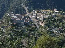 A general view of the village of Thiéry | |
 Coat of arms | |
Location of Thiéry | |
 Thiéry 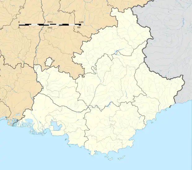 Thiéry | |
| Coordinates: 43°58′45″N 7°01′52″E / 43.9792°N 7.0311°E | |
| Country | France |
| Region | Provence-Alpes-Côte d'Azur |
| Department | Alpes-Maritimes |
| Arrondissement | Nice |
| Canton | Vence |
| Government | |
| • Mayor (2020–2026) | Thierry Grandbouche[1] |
| Area 1 | 22.24 km2 (8.59 sq mi) |
| Population | 103 |
| • Density | 4.6/km2 (12/sq mi) |
| Time zone | UTC+01:00 (CET) |
| • Summer (DST) | UTC+02:00 (CEST) |
| INSEE/Postal code | 06139 /06710 |
| Elevation | 351–1,783 m (1,152–5,850 ft) (avg. 1,050 m or 3,440 ft) |
| 1 French Land Register data, which excludes lakes, ponds, glaciers > 1 km2 (0.386 sq mi or 247 acres) and river estuaries. | |
Thiéry (French pronunciation: [tjeʁi]; Occitan: Tièri; Italian: Tieri, formerly) is a rural commune in the Alpes-Maritimes department in the southeastern Provence-Alpes-Côte d'Azur region in France.
Geography
The commune is traversed by the river Cians.
Demographics
| Year | Pop. | ±% p.a. |
|---|---|---|
| 1968 | 57 | — |
| 1975 | 58 | +0.25% |
| 1982 | 71 | +2.93% |
| 1990 | 83 | +1.97% |
| 1999 | 93 | +1.27% |
| 2009 | 102 | +0.93% |
| 2014 | 102 | +0.00% |
| 2020 | 107 | +0.80% |
| Source: INSEE[3] | ||
See also
References
- ↑ "Répertoire national des élus: les maires". data.gouv.fr, Plateforme ouverte des données publiques françaises (in French). 2 December 2020.
- ↑ "Populations légales 2021". The National Institute of Statistics and Economic Studies. 28 December 2023.
- ↑ Population en historique depuis 1968, INSEE
Wikimedia Commons has media related to Thiéry, Alpes-Maritimes.
This article is issued from Wikipedia. The text is licensed under Creative Commons - Attribution - Sharealike. Additional terms may apply for the media files.