Ulanbel
Ұланбел | |
|---|---|
Village | |
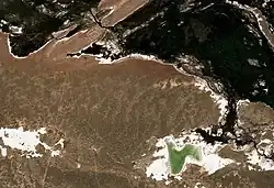 Ulanbel village (upper left) and lake Zhalanash (lower right) Sentinel-2 image | |
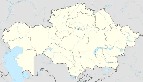 Ulanbel Location in Kazakhstan | |
| Coordinates: 44°49′30″N 71°00′15″E / 44.82500°N 71.00417°E | |
| Country | Kazakhstan |
| Region | Jambyl Region |
| District | Moiynkum District |
| Population (2009) | |
| • Total | 1,047 |
| Time zone | UTC+6 (East Kazakhstan Time) |
| Post code | 080621 |
Ulanbel (Kazakh: Ұланбел) is a village in Moiynkum District, Jambyl Region, Kazakhstan. It is the administrative center of the Ulanbel Rural District (KATO code - 315647100).[1] Population: 1,047 (2009 Census results);[2] 1,455 (1999 Census results).[2][3]
Geography
The village lies at the northern edge of the Moiynkum Desert. It is located by the left bank of the lower course of the Chu river, 8 kilometers (5.0 mi) to the northwest of lake Zhalanash and 154 kilometers (96 mi) to the WNW of Moiynkum, the district capital.[4][5][6]
References
- ↑ "База КАТО". Агентство Республики Казахстан по статистике. Archived from the original on 2013-03-10.
- 1 2 "Население Республики Казахстан" [Population of the Republic of Kazakhstan] (in Russian). Департамент социальной и демографической статистики. Retrieved 8 December 2013.
- ↑ "Итоги Национальной переписи населения Республики Казахстан 2009 года" (PDF). Агентство Республики Казахстан по статистике. Archived from the original (PDF) on 2013-02-27.
- ↑ "L-42 Topographic Chart (in Russian)". Retrieved 26 January 2023.
- ↑ Google Earth.
- ↑ Kazakhstan National encyclopedia / Chief editor A. Nysanbayev - Almaty, 1998. ISBN 5-89800-123-9

This article is issued from Wikipedia. The text is licensed under Creative Commons - Attribution - Sharealike. Additional terms may apply for the media files.