Výrov | |
|---|---|
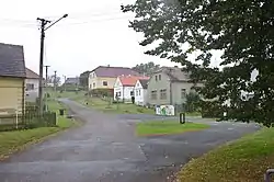 Crossroads | |
 Výrov Location in the Czech Republic | |
| Coordinates: 49°57′43″N 13°27′45″E / 49.96194°N 13.46250°E | |
| Country | |
| Region | Plzeň |
| District | Plzeň-North |
| First mentioned | 1307 |
| Area | |
| • Total | 9.50 km2 (3.67 sq mi) |
| Elevation | 448 m (1,470 ft) |
| Population (2023-01-01)[1] | |
| • Total | 461 |
| • Density | 49/km2 (130/sq mi) |
| Time zone | UTC+1 (CET) |
| • Summer (DST) | UTC+2 (CEST) |
| Postal code | 331 41 |
| Website | www |
Výrov (German: Wegrow) is a municipality and village in Plzeň-North District in the Plzeň Region of the Czech Republic. It has about 500 inhabitants.
Administrative parts
The village of Hadačka is an administrative part of Výrov.
Geography
Výrov is located about 24 kilometres (15 mi) north of Plzeň. It lies in the Plasy Uplands, in a mainly agricultural landscape.
References
Wikimedia Commons has media related to Výrov.
This article is issued from Wikipedia. The text is licensed under Creative Commons - Attribution - Sharealike. Additional terms may apply for the media files.