| Verdigre Creek Tributary to Niobrara River | |
|---|---|
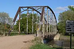
 Gross State Aid Bridge across Verdigre Creek in Knox County, NE | |
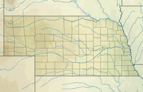
 Location of Verdigre Creek mouth  Verdigre Creek (the United States) | |
| Location | |
| Country | United States |
| State | Nebraska |
| County | Knox |
| Village | Verdigre |
| Physical characteristics | |
| Source | confluence of South Branch Verdigre Creek and East Branch Verdigre Creek |
| • location | about 8 miles east-southeast of Venus, Nebraska |
| • coordinates | 42°26′16.01″N 098°03′23.26″W / 42.4377806°N 98.0564611°W[1] |
| • elevation | 1,548 ft (472 m)[1] |
| Mouth | Niobrara River |
• location | about 4 miles south-southwest of Niobrara, Nebraska |
• coordinates | 42°42′0.00″N 098°03′23.26″W / 42.7000000°N 98.0564611°W[1] |
• elevation | 1,243 ft (379 m)[1] |
| Length | 23.75 mi (38.22 km)[2] |
| Basin size | 519.55 square miles (1,345.6 km2)[3] |
| Discharge | |
| • location | Niobrara River |
| • average | 54.92 cu ft/s (1.555 m3/s) at mouth with Niobrara River[3] |
| Basin features | |
| Progression | Niobrara River → Missouri River → Mississippi River → Gulf of Mexico |
| River system | Missouri River |
| Tributaries | |
| • left | South Branch Verdigre Creek Middle Branch Verdigre Creek North Branch Verdigre Creek |
| • right | East Branch Verdigre Creek Cottonwood Creek Merriman Creek |
| Bridges | 872 Road 873rd Road 519 Avenue 521 Road Highway 54A Main Street 885 Road |
| Designated | May 24, 1991 |
Verdigre Creek is a stream in Knox and Antelope counties, in the U.S. state of Nebraska.[4]
Verdigre is derived from the Spanish word verde meaning "green"; the name was applied to the stream for the green soil on its banks.[5] Verdigre Creek was previously also known as Mauvaius River.[4] The creek begins near 42°26′16″N 98°08′19″W / 42.4377814°N 98.1386834°W where its tributaries, South Branch Verdigre Creek and East Branch Verdigre Creek converge on the mainstream, from there the creek flows through Verdigre, Nebraska and its mouth opens into the Niobrara River at 42°42′00″N 98°03′23″W / 42.7000013°N 98.0564607°W about eight miles north of the town.[4]
See also
References
- 1 2 3 4 "Geographic Names Information System". edits.nationalmap.gov. US Geological Survey. Retrieved 24 October 2022.
- ↑ "ArcGIS Web Application". epa.maps.arcgis.com. US EPA. Retrieved 24 October 2022.
- 1 2 "Verdigre Creek Watershed Report". watersgeo.epa.gov. US EPA. Retrieved 24 October 2022.
- 1 2 3 U.S. Geological Survey Geographic Names Information System: Verdigre Creek
- ↑ Chicago and North Western Railway Company (1908). A History of the Origin of the Place Names Connected with the Chicago & North Western and Chicago, St. Paul, Minneapolis & Omaha Railways. p. 133.
This article is issued from Wikipedia. The text is licensed under Creative Commons - Attribution - Sharealike. Additional terms may apply for the media files.