Villers-sous-Montrond | |
|---|---|
Part of Les Monts-Ronds | |
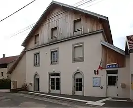 The town hall in Villers-sous-Montrond | |
Location of Villers-sous-Montrond | |
 Villers-sous-Montrond  Villers-sous-Montrond | |
| Coordinates: 47°08′45″N 6°05′21″E / 47.1458°N 6.0892°E | |
| Country | France |
| Region | Bourgogne-Franche-Comté |
| Department | Doubs |
| Arrondissement | Besançon |
| Canton | Ornans |
| Commune | Les Monts-Ronds |
| Area 1 | 6.33 km2 (2.44 sq mi) |
| Population (2019)[1] | 210 |
| • Density | 33/km2 (86/sq mi) |
| Time zone | UTC+01:00 (CET) |
| • Summer (DST) | UTC+02:00 (CEST) |
| Postal code | 25620 |
| Elevation | 444–624 m (1,457–2,047 ft) |
| 1 French Land Register data, which excludes lakes, ponds, glaciers > 1 km2 (0.386 sq mi or 247 acres) and river estuaries. | |
Villers-sous-Montrond (French pronunciation: [vilɛʁ su mɔ̃tʁɔ̃], literally Villers on Montrond) is a former commune in the Doubs department in the Bourgogne-Franche-Comté region in eastern France. On 1 January 2022, it was merged into the new commune of Les Monts-Ronds.[2]
Population
| Year | Pop. | ±% |
|---|---|---|
| 1962 | 95 | — |
| 1968 | 113 | +18.9% |
| 1975 | 112 | −0.9% |
| 1982 | 139 | +24.1% |
| 1990 | 148 | +6.5% |
| 1999 | 163 | +10.1% |
| 2008 | 169 | +3.7% |
| 2019 | 210 | +24.3% |
See also
References
- ↑ Téléchargement du fichier d'ensemble des populations légales en 2019, INSEE
- ↑ Arrêté préfectoral, p. 39, 22 December 2021 (in French)
Wikimedia Commons has media related to Villers-sous-Montrond.
This article is issued from Wikipedia. The text is licensed under Creative Commons - Attribution - Sharealike. Additional terms may apply for the media files.