Montrond-le-Château | |
|---|---|
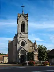 The church in Montrond-le-Château | |
 Coat of arms | |
Location of Montrond-le-Château | |
 Montrond-le-Château  Montrond-le-Château | |
| Coordinates: 47°08′39″N 6°02′48″E / 47.1442°N 6.0467°E | |
| Country | France |
| Region | Bourgogne-Franche-Comté |
| Department | Doubs |
| Arrondissement | Besançon |
| Canton | Saint-Vit |
| Intercommunality | Loue-Lison |
| Government | |
| • Mayor (2020–2026) | Angèle Prillard[1] |
| Area 1 | 10.9 km2 (4.2 sq mi) |
| Population | 563 |
| • Density | 52/km2 (130/sq mi) |
| Time zone | UTC+01:00 (CET) |
| • Summer (DST) | UTC+02:00 (CEST) |
| INSEE/Postal code | 25406 /25660 |
| Elevation | 407–525 m (1,335–1,722 ft) |
| 1 French Land Register data, which excludes lakes, ponds, glaciers > 1 km2 (0.386 sq mi or 247 acres) and river estuaries. | |
Montrond-le-Château (French pronunciation: [mɔ̃tʁɔ̃ lə ʃato]) is a commune in the Doubs department in the Bourgogne-Franche-Comté region in eastern France.
Geography
The commune lies 22 km (14 mi) northeast of Quingey.
Population
| Year | Pop. | ±% |
|---|---|---|
| 1962 | 296 | — |
| 1968 | 310 | +4.7% |
| 1975 | 279 | −10.0% |
| 1982 | 320 | +14.7% |
| 1990 | 393 | +22.8% |
| 1999 | 471 | +19.8% |
| 2008 | 561 | +19.1% |
| 2012 | 590 | +5.2% |
See also
References
- ↑ "Répertoire national des élus: les maires". data.gouv.fr, Plateforme ouverte des données publiques françaises (in French). 9 August 2021.
- ↑ "Populations légales 2021". The National Institute of Statistics and Economic Studies. 28 December 2023.
External links
Wikimedia Commons has media related to Montrond-le-Château.
This article is issued from Wikipedia. The text is licensed under Creative Commons - Attribution - Sharealike. Additional terms may apply for the media files.