Voznice | |
|---|---|
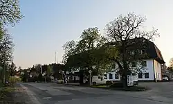
 Hotel Voznice and main road | |
 Flag  Coat of arms | |
 Voznice Location in the Czech Republic | |
| Coordinates: 49°49′2″N 14°13′0″E / 49.81722°N 14.21667°E | |
| Country | |
| Region | Central Bohemian |
| District | Příbram |
| First mentioned | 1788 |
| Area | |
| • Total | 14.32 km2 (5.53 sq mi) |
| Elevation | 373 m (1,224 ft) |
| Population (2023-01-01)[1] | |
| • Total | 728 |
| • Density | 51/km2 (130/sq mi) |
| Time zone | UTC+1 (CET) |
| • Summer (DST) | UTC+2 (CEST) |
| Postal code | 263 01 |
| Website | www |
Voznice is a municipality and village in Příbram District in the Central Bohemian Region of the Czech Republic. It has about 700 inhabitants.
Administrative parts
The village of Chouzavá is an administrative part of Voznice.
Geography
Voznice is located about 20 kilometres (12 mi) northeast of Příbram and 26 km (16 mi) southwest of Prague. The eastern part of the municipality lies in the Benešov Uplands, the western part lies in the Brdy Highlands. The highest point is a contour line at 515 m (1,690 ft) above sea level. The village is surrounded on all sides by woods.
History
The first written mention of Voznice is from 1788. The village was founded by the House of Mansfeld, who owned the Dobříš estate, to which it belonged. In the interwar period of the 20th century, Voznice was a popular place for the recreation of prominent people from Prague.[2]
Transport
The D4 motorway runs along the western municipal border.
Sights
Voznice is poor in monuments. The only protected cultural monument is a statue of St. John of Nepomuk from the first half of the 18th century.[3]
References
- ↑ "Population of Municipalities – 1 January 2023". Czech Statistical Office. 2023-05-23.
- ↑ "O obci" (in Czech). Obec Voznice. Retrieved 2023-02-24.
- ↑ "Výsledky vyhledávání: Kulturní památky, obec Voznice". Ústřední seznam kulturních památek (in Czech). National Heritage Institute. Retrieved 2023-07-01.