Winsum | |
|---|---|
Village | |
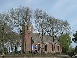
 Winsum church | |
 Flag _wapen.svg.png.webp) Coat of arms | |
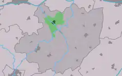
 Location in the former Littenseradiel municipality | |
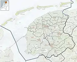
 Winsum Location in the Netherlands  Winsum Winsum (Netherlands) | |
| Coordinates: 53°9′9″N 5°37′58″E / 53.15250°N 5.63278°E | |
| Country | Netherlands |
| Province | Friesland |
| Municipality | Waadhoeke |
| Area | |
| • Total | 8.71 km2 (3.36 sq mi) |
| Elevation | 0.2 m (0.7 ft) |
| Population (2021)[1] | |
| • Total | 1,025 |
| • Density | 120/km2 (300/sq mi) |
| Postal code | 8831[1] |
| Dialing code | 0517 |
| Website | Official |
Winsum (Dutch pronunciation: [ˈʋɪn.sʏm]) is a village in Waadhoeke municipality in the province of Friesland, the Netherlands. It had a population of around 1,038 in January 2017.[3]
History
The village was first mentioned in the 13th century as Winshyum, and means "settlement of Winika (person)".[4] Winsum developed in the middle ages.[5] It is a terp (artificial living hill) village and one of the tallest, however it is not apparent due to the gentle slope. There was a second terp, however it was excavated in the late-19th century.[6]
The Dutch Reformed church dates from the 15th or early-16th century. The tower has been built around 1880.[5]
Winsum was home to 546 people in 1840.[7] In 1897, the dairy factory Klimop opened in Winsum. It was in operation until 1939. Only the chimney remains.[5]
The windmill Langwert was built in 1974 as a replacement of an 1863 windmill which burnt down on 13 March 1974. It is a polder mill to drain the excess water from the polder. In 2011, it was damaged in a storm. Since 2014, it is once again in operation.[8]
Until 2018, the village was part of the Littenseradiel municipality and before 1984 it belonged to Baarderadeel municipality.[7]
Notable people
Gallery
 Langwert Mill
.jpg.webp) Turn left for Winsum
Turn left for Winsum Canal view
 Farmer plowing with horse (unknown date)
References
- 1 2 3 "Kerncijfers wijken en buurten 2021". Central Bureau of Statistics. Retrieved 3 April 2022.
- ↑ "Postcodetool for 8831KM". Actueel Hoogtebestand Nederland (in Dutch). Het Waterschapshuis. Retrieved 3 April 2022.
- ↑ Aantal inwoners per dorp - Littenseradiel
- ↑ "Winsum - (geografische naam)". Plaatsengids (in Dutch). Retrieved 3 April 2022.
- 1 2 3 Ronald Stenvert & Sabine Broekhoven (2000). "Winsum" (in Dutch). Zwolle: Waanders. ISBN 90 400 9476 4. Retrieved 3 April 2022.
- ↑ "Winsum". Friesland Wonderland (in Dutch). Retrieved 3 April 2022.
- 1 2 "Winsum (Fryslan)". Plaatsengids (in Dutch). Retrieved 3 April 2022.
- ↑ "Langwert". Molen database (in Dutch). Retrieved 3 April 2022.
- ↑ "Mr. J. (Jo) Meynen". Dutch Parliament (in Dutch). Retrieved 3 April 2022.
External links
![]() Media related to Winsum (Friesland) at Wikimedia Commons
Media related to Winsum (Friesland) at Wikimedia Commons