| IND World's Fair Line | ||||||||||||||||||||||||||||||||||||||||||||||||||||||
|---|---|---|---|---|---|---|---|---|---|---|---|---|---|---|---|---|---|---|---|---|---|---|---|---|---|---|---|---|---|---|---|---|---|---|---|---|---|---|---|---|---|---|---|---|---|---|---|---|---|---|---|---|---|---|
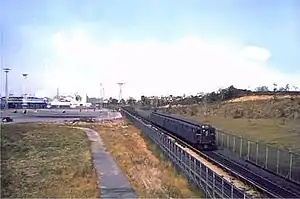 A colored image of a GG train on the IND World's Fair Line c. 1939. This is one of the few colored pictures of the line in existence. | ||||||||||||||||||||||||||||||||||||||||||||||||||||||
| Overview | ||||||||||||||||||||||||||||||||||||||||||||||||||||||
| Status | Demolished | |||||||||||||||||||||||||||||||||||||||||||||||||||||
| Locale | Queens, New York City, New York | |||||||||||||||||||||||||||||||||||||||||||||||||||||
| Termini |
| |||||||||||||||||||||||||||||||||||||||||||||||||||||
| Stations | 1 | |||||||||||||||||||||||||||||||||||||||||||||||||||||
| Service | ||||||||||||||||||||||||||||||||||||||||||||||||||||||
| Type | Rapid transit | |||||||||||||||||||||||||||||||||||||||||||||||||||||
| System | New York City Subway Independent Subway System | |||||||||||||||||||||||||||||||||||||||||||||||||||||
| Services | IND Queens Boulevard Line | |||||||||||||||||||||||||||||||||||||||||||||||||||||
| Depot(s) | Jamaica Yard | |||||||||||||||||||||||||||||||||||||||||||||||||||||
| Rolling stock | R1-9[1] | |||||||||||||||||||||||||||||||||||||||||||||||||||||
| History | ||||||||||||||||||||||||||||||||||||||||||||||||||||||
| Opened | April 22, 1939 | |||||||||||||||||||||||||||||||||||||||||||||||||||||
| Closed | October 28, 1940 | |||||||||||||||||||||||||||||||||||||||||||||||||||||
| Technical | ||||||||||||||||||||||||||||||||||||||||||||||||||||||
| Line length | 8,400 feet (2,600 m) | |||||||||||||||||||||||||||||||||||||||||||||||||||||
| Track gauge | 1,435 mm (4 ft 8+1⁄2 in) standard gauge | |||||||||||||||||||||||||||||||||||||||||||||||||||||
| ||||||||||||||||||||||||||||||||||||||||||||||||||||||
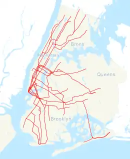
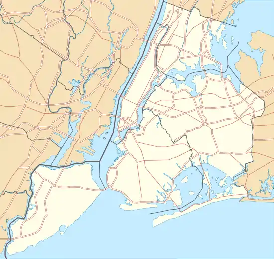
The IND World's Fair Line, officially the World's Fair Railroad,[2] was a temporary branch of the Independent Subway System (IND) serving the 1939 New York World's Fair in Queens, New York City. It split from the IND Queens Boulevard Line at an existing flying junction east of Forest Hills–71st Avenue station, ran through the Jamaica Yard and then ran northeast and north through Flushing Meadows–Corona Park, roughly along the current path of the Van Wyck Expressway. The line continued along a wooden trestle to the World's Fair Railroad Station, located slightly south of Horace Harding Boulevard (now the Long Island Expressway). The World's Fair station, the only one on the line, consisted of two tracks and three platforms.
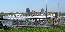
The line was planned beginning in 1936, and it was constructed in 1938. The line and station were only open in 1939 and 1940 during the Fair's operating season. Passengers had to pay a ten-cent fare to use this line, double the subway's standard five-cent fare. This was not the only line to serve the world's fair. The Interborough Rapid Transit and the Brooklyn Manhattan Transit operated service to the Fair via the World's Fair station of their joint-operated IRT Flushing Line. The World's Fair Railroad and station are the only IND line and station to have been closed and demolished.[1][3][4] Remnants of the line are still present in the Jamaica Yard.
History
In 1935, New York City Parks Commissioner Robert Moses selected the then-new Flushing Meadows–Corona Park in central Queens for what would become the 1939 New York World's Fair.[5] In December 1936, the Board of Transportation and the New York State Transit Commission sent a request to the New York City Board of Estimate in order to have adequate rapid transit facilities to handle World's Fair crowds when the fair opened in 1939. An extension of the city-operated Independent Subway System (IND) to the World's Fair was part of this plan. It was facilitated by the extension of the Queens Boulevard Line to Union Turnpike and the nearby Jamaica storage yard, all of which had opened at the end of December 1936. It was originally expected that the World's Fair spur would cost about $1.2 million, of which $700,000 was allocated on construction and $500,000 was allocated for equipment.[6][7][8] However, it ended up costing $1.7 million.[9] For legal and financial reasons, the line was called the "World's Fair Railroad" and was considered a separate entity from the IND. Part of this designation included the state legislation approving the "double-fare" for the line (see § Station).[2][10][11]
The Board of Transportation awarded the contract for the IND World's Fair Line on October 26, 1937, to the P. T. Cox Contracting Company. The company had been the lowest bidder for the contract, having offered to construct the trestle for the World's Fair Line at a cost of $308,770.[12][13] The World's Fair extension was opposed by Parks Commissioner Moses, who believed the new subway spur would be "extravagant and wasteful".[14][15]
During the line's planning stages in 1937, the Board of Estimate considered making the line a permanent connection to Flushing Meadows Park following the end of the fair. They also looked at the possibility of intermediate stations along the line to serve the local areas, comprising what is now Kew Gardens Hills and Flushing. The upgrades to make the line permanent would have cost around $6 million. However, it was determined to be impractical due to the absence of permanent attractions in the park at the time;[16][17] these attractions, such as the Citi Field baseball park and the USTA National Tennis Center, were not added until later.[18]

In early 1938, construction on the IND World's Fair Line began.[19] It originated at the Queens Boulevard portal of Jamaica Yard as a continuation of the tracks that diverged from the Queens Boulevard Line east of 71st−Continental Avenues. The line ran along the eastern edge of Flushing Meadows–Corona Park for 8,400 feet (2,600 m) to approximately what is now the interchange of the Long Island Expressway and the Van Wyck Expressway.[6][7][16][20] The line consisted of two tracks ending in a stub-end terminal called World's Fair Station. The marshy swampland in the line's right-of-way was filled in, and a trestle was built over the landfill.[12] The line was designed to be removed following the fair in 1940.[17]
Test trains on the IND World's Fair Line were run beginning on April 22, 1939, and the line opened on April 30, 1939.[21]: 314, 409 [22]: 83 [23] The GG local train mostly serviced the line, running between Smith–Ninth Streets and the World's Fair Station.[24] Additional E express service ran between World's Fair Station and Hudson Terminal during afternoon rush hours and evenings. Passengers on the E or F trains who were not going to the Fair would transfer at Continental Avenue.[21]: 264 Service generally ran until 1:30am.[25][26]
The 1939 World's Fair had two seasons: one each in 1939 and 1940, which ended in the fall months of the year. Service for the first season ended on November 1, 1939, and during this season the line's ridership was 7,066,966.[27]: 189 The IND World's Fair Line was closed between seasons, and at the end of the Fair the line was set to be demolished. The last train ran on October 28, 1940, the day after the closure of the Fair.[22]: 27, 83 While most of the fairgrounds were torn down soon after the event, the line remained intact for several months afterward. Queens borough president George U. Harvey proposed extending the line to serve the then-developing neighborhoods of Flushing, College Point, and Whitestone, along with the recently opened Queens College. This plan was supported by the local communities, elected officials in Queens, and the president of Queens College. It was deemed to be unfeasible, however, by the Board of Transportation due to the fact that the trestle was constructed to be temporary, and due to regulations at the time which required permanent lines for subway service to be built underground. Parks and highway commissioner Robert Moses, meanwhile, wished to utilize the right-of-way for the further development of Flushing Meadows Park and the extension of the Van Wyck Expressway towards the Whitestone Expressway and the Whitestone Bridge. Demolition of the line was authorized in December 1940, and on January 15, 1941, removal of the line commenced. The right-of-way was replaced with an extension of 136th Street, and eventually the northern portion of the Van Wyck Expressway which formed today's Interstate 678.[18][9][28] Seven train signals that were modified for the World's Fair Line still exist along the Jamaica Yard's track connections to the Queens Boulevard Line. Instead of controlling the speeds of passenger trains, these signals are now used to control the speeds of yard traffic.[3]
Preparation for the 1964 World's Fair started in 1960. An extension of the IND Queens Boulevard Line to the fair grounds was considered. Robert Moses, who was going to take over as president of the World's Fair on May 15, 1960, rejected the proposal once he found out that the line would have cost $10 million.[29] In the end, improved Flushing Line service, and increased E, F, and GG service on the Queens Boulevard Line would provide improved transportation facilities for the fair.[22]: 83
Station
World's Fair | |||||||||||||||||||||||||||||||
|---|---|---|---|---|---|---|---|---|---|---|---|---|---|---|---|---|---|---|---|---|---|---|---|---|---|---|---|---|---|---|---|
| Former New York City Subway station | |||||||||||||||||||||||||||||||
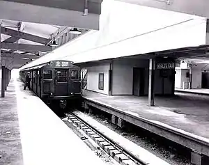 A subway train at the station | |||||||||||||||||||||||||||||||
| Station statistics | |||||||||||||||||||||||||||||||
| Borough | Queens | ||||||||||||||||||||||||||||||
| Locale | Flushing Meadows | ||||||||||||||||||||||||||||||
| Coordinates | 40°44′34″N 73°50′16″W / 40.742753°N 73.837762°W | ||||||||||||||||||||||||||||||
| Division | [30] | ||||||||||||||||||||||||||||||
| Line | IND Queens Boulevard/World's Fair Line | ||||||||||||||||||||||||||||||
| Services | None (demolished) | ||||||||||||||||||||||||||||||
| Structure | At-grade | ||||||||||||||||||||||||||||||
| Platforms | 1 island platform 2 side platforms Spanish solution | ||||||||||||||||||||||||||||||
| Tracks | 2 | ||||||||||||||||||||||||||||||
| Other information | |||||||||||||||||||||||||||||||
| Opened | April 30, 1939[4] | ||||||||||||||||||||||||||||||
| Closed | October 28, 1940[4] | ||||||||||||||||||||||||||||||
| Former/other names | Horace Harding Boulevard[25] | ||||||||||||||||||||||||||||||
| Station succession | |||||||||||||||||||||||||||||||
| Next north | (Terminal) | ||||||||||||||||||||||||||||||
| Next south | Forest Hills–71st Avenue | ||||||||||||||||||||||||||||||
| |||||||||||||||||||||||||||||||
| |||||||||||||||||||||||||||||||
| |||||||||||||||||||||||||||||||
Attractions and geographical features of Flushing Meadows–Corona Park:
The World's Fair station was the line's northern terminus[lower-alpha 1] and its sole station, located in the Amusement Area of the World's Fair.[6][7][12][9] The station was a temporary[17][20] stub-end terminal with two tracks and three platforms, organized in a Spanish solution. A third siding was built south of the station.[3] The stop was alternately named the Horace Harding Boulevard station, after the avenue where it was located.[25] It was open for only nineteen months, from April 30, 1939, to October 28, 1940.[21]: 314, 409
To enter the station, an additional 5-cent fare was charged on top of the standard nickel fare. Eighteen special turnstiles were used at the World's Fair station that permitted traffic flow in both directions and accepted two different fares depending on the direction of travel. Fairgoers disembarking from trains paid a nickel as they exited through the turnstiles while passengers entering the station from the fairgrounds paid a ten-cent fare upon passing through the turnstiles.[1][10][11][24] The double-fare was instituted to avoid a financial deficit.[11] A double fare was later implemented on stations of the IND Rockaway Line, which opened in 1956 and used this fare system until 1975.[18][31][32]
Competing IRT and BMT service
The Interborough Rapid Transit Company (IRT) and Brooklyn–Manhattan Transit Corporation (BMT) also served the World's Fair, but did so directly with World's Fair (now Mets–Willets Point) station on the dual-operated Flushing Line, which was rebuilt into an express station for the Fair. A Long Island Rail Road station, the current Mets–Willets Point station, was built next to the Flushing Line station.[10]
Notes
- ↑ Geographically, trains running southeast on the Queens Boulevard Line would then turn northward along the World's Fair Line. In terms of railroad directions, however, the trains would be traveling "railroad north" for the entire duration of their trip.
References
- 1 2 3 Marzlock, Ron (October 25, 2007). "IND Subway Line To 1939 World's Fair". qchron.com. Queens Chronicle. Archived from the original on January 27, 2018. Retrieved July 6, 2015.
- 1 2 "WORLD'S FAIR SPUR MAY CHARGE DIME; Independent Subway Link to Have Turnstiles With 2-Way Coin Mechanism PAY TO GET OUT REQUIRED City Authorization Lacking for Plan, Devised to Avoid Deficit in Operation Spur Held Separate Line Road to Cost $2,000,000" (PDF). The New York Times. August 27, 1938. Archived from the original on September 30, 2023. Retrieved July 7, 2015.
- 1 2 3 Rosenthal, David. "IND 1939 Worlds Fair Line". www.nycsubway.org. Archived from the original on December 16, 2017. Retrieved November 9, 2017.
- 1 2 3 Feinman, Mark (2000). "History of the Independent Subway". www.nycsubway.org. Archived from the original on December 25, 2017. Retrieved November 9, 2017.
- ↑ "Great World Fair for City in 1939 on Site In Queens;...City to Lend New Park" (PDF). The New York Times. September 23, 1935. Archived from the original on September 30, 2023. Retrieved January 29, 2012.
- 1 2 3 "EXPANDED TRANSIT FOR FAIR IS ASKED; State and City Boards Join in Plea for Appropriation of $1,850,000" (PDF). The New York Times. December 24, 1936. Retrieved July 6, 2015.
- 1 2 3 "TEST TRAINS RUNNING IN QUEENS SUBWAY: Switch and Signal Equipment of New Independent Line Is Being Checked" (PDF). The New York Times. December 20, 1936. Archived from the original on September 30, 2023. Retrieved July 6, 2015.
- ↑ "Plans to be Drawn for 6th Av. Subway" (PDF). The New York Times. April 1, 1935. Archived from the original on September 30, 2023. Retrieved June 30, 2015.
- 1 2 3 "CITY LINE TO FAIR CARRIED 7,066,948; 2-Mile Spur Had Only 54% of Passengers Expected From Attendance Estimates" (PDF). The New York Times. November 3, 1939. Archived from the original on September 30, 2023. Retrieved July 7, 2015.
- 1 2 3 "Ride to Fair to Cost 10 Cents: City to Set Rate for Independent Branch Line to Cover Expense of Building It". The New York Sun. Fultonhistory.com. February 18, 1939. p. 21. Archived from the original on October 13, 2021. Retrieved July 31, 2016.
- 1 2 3 "City Prepared For Dime Fare To Exposition: Passengers Would Pay Nickel on Leaving World's Fair Spur". Brooklyn Daily Eagle. August 27, 1938. p. 2. Archived from the original on October 24, 2020. Retrieved August 5, 2016 – via Newspapers.com.
- 1 2 3 "TO BUILD FAIR SUBWAY P. T. Cox Co. Wins Award for Extending Independent System" (PDF). The New York Times. October 27, 1937. Archived from the original on October 7, 2022. Retrieved July 6, 2015.
- ↑ "Contract Is Let For Spur to Fair: P.T. Cox Co. to Build 2-Track Link With City Subway-Cost $308,770". Brooklyn Daily Eagle. Fultonhistory.com. October 27, 1937. p. 4. Archived from the original on October 13, 2021. Retrieved July 30, 2016.
- ↑ "MAYOR ASKS DATA ON SUBWAY TO FAIR: Calls Hearing on Proposal for Independent Line Spur in Spite of Moses's Criticism" (PDF). The New York Times. February 6, 1937. Archived from the original on September 30, 2023. Retrieved July 6, 2015.
- ↑ "Moses Assails Proposed City Subway to Fair". Brooklyn Daily Eagle. February 4, 1937. p. 2. Archived from the original on February 14, 2017. Retrieved July 4, 2016 – via Newspapers.com.
- 1 2 "Fair Subway Cost Set at $1,700,000" (PDF). The New York Times. July 22, 1937. Archived from the original on September 30, 2023. Retrieved June 13, 2018.
- 1 2 3 "BOARD GETS REPORT ON FAIR SUBWAY SPUR; Estimated Cost Is $1,742,000 for Construction, Operation and Removal in 1940" (PDF). The New York Times. July 3, 1937. Archived from the original on September 30, 2023. Retrieved July 7, 2015.
- 1 2 3 Raskin, Joseph B. (2013). The Routes Not Taken: A Trip Through New York City's Unbuilt Subway System. New York, New York: Fordham University Press. doi:10.5422/fordham/9780823253692.001.0001. ISBN 978-0-82325-369-2.
- ↑ "Transit Facilities to the Fair Are Tested" (PDF). The New York Times. May 1, 1938. Archived from the original on September 30, 2023. Retrieved December 16, 2017.
- 1 2 "CITY SUBWAY SPUR TO THE FAIR URGED: Delaney and Fullen Jointly Propose Extension From Queens Boulevard. COST PUT AT $1,200,000 Enlargement of Willets Point 1. R. T.-B. M. T. Station Also Is Recommended. Expenses Are Estimated Two Tracks Are Provided" (PDF). The New York Times. January 15, 1937. Retrieved July 6, 2015.
- 1 2 3 Proceedings. New York City Board of Transportation. April 24, 1939. Archived from the original on September 30, 2023. Retrieved May 10, 2021.
- 1 2 3 Cunningham, Joseph; DeHart, Leonard O. (1993). A History of the New York City Subway System. J. Schmidt, R. Giglio, and K. Lang. Archived from the original on September 30, 2023. Retrieved May 10, 2021.
- ↑ "Subway Service To Start Fair Service April 30". New York Daily News. April 16, 1939. Archived from the original on October 7, 2022. Retrieved March 14, 2019.
- 1 2 "CITY SUBWAY RIDE TO FAIR TO COST 10C Board Holds Dime Charge Is Necessary to Pay for Branch Line to the Grounds" (PDF). The New York Times. February 18, 1939. Archived from the original on September 30, 2023. Retrieved July 6, 2015.
- 1 2 3 "HOW TO GET TO THE FAIR GROUNDS; BY SUBWAY" (PDF). The New York Times. April 30, 1939. Archived from the original on September 30, 2023. Retrieved July 7, 2015.
- ↑ "NEW SUBWAY SPUR IS READY TO OPEN: First Train to Start Four Minutes Before the Fair Officially Begins" (PDF). The New York Times. April 17, 1939. Archived from the original on September 30, 2023. Retrieved July 7, 2015.
- ↑ North, Simon Newton Dexter; Wickware, Francis Graham; Hart, Albert Bushnell (1940). The American Year Book. Thomas Nelson & Sons. Archived from the original on September 30, 2023. Retrieved May 10, 2021.
- ↑ "END OF SUBWAY SPUR TO FAIR NOW URGED: Transportation Board Asks the Right to Demolish It" (PDF). The New York Times. November 26, 1940. Archived from the original on September 30, 2023. Retrieved July 7, 2015.
- ↑ "64 FAIR PLANS SET BY TRANSIT BOARD; Authority Seeks 10 Million for 80 More Cars -- Will Improve IRT Station IND EXTENSION VETOED Moses Against Expense of Building New Spur -- Some '39 Structures Remain" (PDF). New York Times. April 27, 1960. Archived from the original on September 30, 2023. Retrieved February 8, 2016.
- ↑ "Glossary". Second Avenue Subway Supplemental Draft Environmental Impact Statement (SDEIS) (PDF). Vol. 1. Metropolitan Transportation Authority. March 4, 2003. pp. 1–2. Archived from the original (PDF) on February 26, 2021. Retrieved January 1, 2021.
- ↑ Freeman, Ira Henry (June 28, 1956). "Rockaway Trains to Operate Today" (PDF). The New York Times. Archived from the original on May 20, 2022. Retrieved June 29, 2015.
- ↑ "Beachcomber". Wave of Long Island. Fultonhistory.com. March 23, 1977. p. 11. Archived from the original on October 13, 2021. Retrieved July 22, 2016.
