Zhangqiu
章丘区 Changkiu | |||||||||||||||||||||||||||||
|---|---|---|---|---|---|---|---|---|---|---|---|---|---|---|---|---|---|---|---|---|---|---|---|---|---|---|---|---|---|
 | |||||||||||||||||||||||||||||
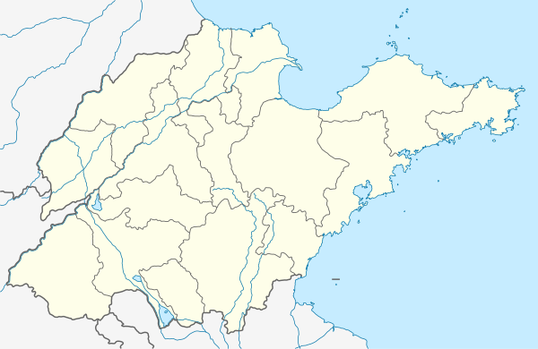
 Zhangqiu Location in Shandong | |||||||||||||||||||||||||||||
| Coordinates: 36°41′35″N 117°31′05″E / 36.693°N 117.518°E[1] | |||||||||||||||||||||||||||||
| Country | People's Republic of China | ||||||||||||||||||||||||||||
| Province | Shandong | ||||||||||||||||||||||||||||
| Sub-provincial city | Jinan | ||||||||||||||||||||||||||||
| Area | |||||||||||||||||||||||||||||
| • District | 1,721.29 km2 (664.59 sq mi) | ||||||||||||||||||||||||||||
| • Metro | 1,721.29 km2 (664.59 sq mi) | ||||||||||||||||||||||||||||
| Population (2010 census)[3] | |||||||||||||||||||||||||||||
| • District | 1,064,210 | ||||||||||||||||||||||||||||
| • Density | 620/km2 (1,600/sq mi) | ||||||||||||||||||||||||||||
| • Metro | 1,064,210 | ||||||||||||||||||||||||||||
| • Metro density | 620/km2 (1,600/sq mi) | ||||||||||||||||||||||||||||
| Time zone | UTC+8 (China Standard) | ||||||||||||||||||||||||||||
| Postal code | 250200 | ||||||||||||||||||||||||||||
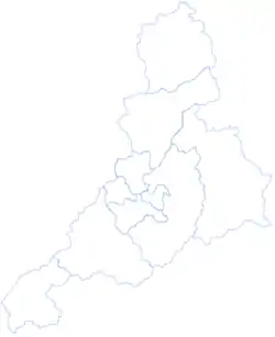
| Jinan district map |
| ||||||||||||||||||||||||||||
Zhangqiu (simplified Chinese: 章丘; traditional Chinese: 章邱; pinyin: Zhāngqiū) is one of 10 urban districts of the prefecture-level city of Jinan, the capital of Shandong Province, East China. The district has an area of 1721.29 square kilometers, 20 towns, 908 villages and the permanent resident population was 1,064,210 as of 2010 even though its built-up (or metro) area is much smaller.
History
Originally called Zhangqiu County with Mingshui (明水) as its capital, Zhangqiu City was established in August 1992. Located in central Shandong province, Zhangqiu is 50 kilometers to the east of Jinan, the capital of Shandong province. It is 120 kilometers north from Mount Tai and the Yellow River is the north border of Zhangqiu. Jinan Yaoqiang International Airport is situated at Yaoqiang Village of Zhangqiu.
Zhangqiu is the hometown of the poet Li Qingzhao in the Song Dynasty, and home to Longshan Culture that existed around 2900~2100 BC. Longshan Culture is known for its black ceramics and the earliest features to late characterize the Shang civilization, scapulimancy and hangtu construction (see Chengziya Archaeological Site).
Zhangqiu is known for its springs and scenery outside the crowded city of Jinan. The East Jingshi Road and several Province Highways connect Mingshui and Jinan.
Administrative divisions
As 2017, this county is divided to 15 subdistricts and 3 towns.[4]
Subdistricts
|
|
-Subdistricts are upgraded from towns.
|
|
Towns
- Diao (刁镇)
- Duozhuang (垛庄镇)
- Huanghe Township (黄河镇) - is upgraded from township.
- Former Town is merged to other.
- Shuizhai (水寨镇)
- Former Townships is merged to other.
- Xinzhai Township (辛寨乡)
Villages
Climate
| Climate data for Zhangqiu (1991–2020 normals, extremes 1981–2010) | |||||||||||||
|---|---|---|---|---|---|---|---|---|---|---|---|---|---|
| Month | Jan | Feb | Mar | Apr | May | Jun | Jul | Aug | Sep | Oct | Nov | Dec | Year |
| Record high °C (°F) | 18.5 (65.3) |
25.5 (77.9) |
30.8 (87.4) |
34.6 (94.3) |
38.4 (101.1) |
40.5 (104.9) |
40.7 (105.3) |
36.9 (98.4) |
38.4 (101.1) |
34.0 (93.2) |
25.6 (78.1) |
19.0 (66.2) |
40.7 (105.3) |
| Mean daily maximum °C (°F) | 3.8 (38.8) |
7.8 (46.0) |
14.1 (57.4) |
21.6 (70.9) |
27.1 (80.8) |
31.3 (88.3) |
31.8 (89.2) |
30.2 (86.4) |
26.8 (80.2) |
21.0 (69.8) |
12.6 (54.7) |
5.7 (42.3) |
19.5 (67.1) |
| Daily mean °C (°F) | −1.3 (29.7) |
2.2 (36.0) |
8.4 (47.1) |
15.7 (60.3) |
21.5 (70.7) |
26.0 (78.8) |
27.3 (81.1) |
25.6 (78.1) |
21.5 (70.7) |
15.5 (59.9) |
7.6 (45.7) |
0.9 (33.6) |
14.2 (57.6) |
| Mean daily minimum °C (°F) | −5.7 (21.7) |
−2.6 (27.3) |
3.0 (37.4) |
9.8 (49.6) |
15.6 (60.1) |
20.5 (68.9) |
23.0 (73.4) |
21.5 (70.7) |
16.4 (61.5) |
10.2 (50.4) |
2.8 (37.0) |
−3.4 (25.9) |
9.3 (48.7) |
| Record low °C (°F) | −21.1 (−6.0) |
−18.5 (−1.3) |
−12.9 (8.8) |
−6.1 (21.0) |
−0.1 (31.8) |
9.2 (48.6) |
14.1 (57.4) |
11.6 (52.9) |
4.9 (40.8) |
−4.9 (23.2) |
−15.6 (3.9) |
−26.8 (−16.2) |
−26.8 (−16.2) |
| Average precipitation mm (inches) | 4.9 (0.19) |
10.6 (0.42) |
12.4 (0.49) |
30.8 (1.21) |
68.6 (2.70) |
88.9 (3.50) |
173.0 (6.81) |
155.2 (6.11) |
58.5 (2.30) |
29.4 (1.16) |
24.4 (0.96) |
7.0 (0.28) |
663.7 (26.13) |
| Average precipitation days (≥ 0.1 mm) | 2.5 | 3.4 | 3.6 | 5.5 | 7.0 | 8.2 | 12.2 | 11.6 | 6.8 | 5.7 | 4.6 | 3.3 | 74.4 |
| Average snowy days | 3.6 | 3.2 | 1.3 | 0.2 | 0 | 0 | 0 | 0 | 0 | 0 | 1.0 | 2.2 | 11.5 |
| Average relative humidity (%) | 55 | 51 | 47 | 49 | 54 | 56 | 73 | 78 | 68 | 60 | 58 | 56 | 59 |
| Mean monthly sunshine hours | 149.1 | 156.7 | 198.1 | 225.8 | 249.9 | 218.2 | 179.3 | 181.7 | 180.8 | 188.5 | 157.4 | 148.6 | 2,234.1 |
| Percent possible sunshine | 48 | 51 | 53 | 57 | 57 | 50 | 40 | 44 | 49 | 55 | 52 | 50 | 51 |
| Source: China Meteorological Administration[5][6] | |||||||||||||
References
- ↑ Google (2 July 2014). "Zhangqiu" (Map). Google Maps. Google. Retrieved 2 July 2014.
- ↑ Jinan City Land Use Plan (2006–20)/《济南市土地利用总体规划(2006-2020年)》.(in Chinese) Accessed 8 July 2014.
- ↑ 《中国2010年人口普查分县资料》 (in Chinese). 中国统计出版社. December 2012. ISBN 978-7-5037-6659-6.
- ↑ 2017年统计用区划代码和城乡划分代码:章丘区 (in Chinese). National Bureau of Statistics of the People's Republic of China. 2017. Retrieved 16 November 2018.
统计用区划代码 名称 370114001000 明水街道办事处 370114002000 双山街道办事处 370114003000 枣园街道办事处 370114004000 龙山街道办事处 370114005000 埠村街道办事处 370114006000 圣井街道办事处 370114007000 普集街道办事处 370114008000 绣惠街道办事处 370114009000 相公庄街道办事处 370114010000 文祖街道办事处 370114011000 官庄街道办事处 370114012000 高官寨街道办事处 370114013000 白云湖街道办事处 370114014000 宁家埠街道办事处 370114015000 曹范街道办事处 370114100000 刁镇 370114101000 垛庄镇 370114102000 黄河镇
- ↑ 中国气象数据网 – WeatherBk Data (in Simplified Chinese). China Meteorological Administration. Retrieved 12 August 2023.
- ↑ 中国气象数据网 (in Simplified Chinese). China Meteorological Administration. Retrieved 12 August 2023.
External links
- Zhangqiu government website (in Chinese)
