Yiyuan County
沂源县 | |
|---|---|
![Tanglang River [zh]](../I/Tanglang_River_2021-05-01_1.jpg.webp) Tanglang River | |
 Location in Zibo | |
 Yiyuan Location of the seat in Shandong | |
| Coordinates (Yiyuan County government): 36°11′06″N 118°10′15″E / 36.1849°N 118.1708°E | |
| Country | People's Republic of China |
| Province | Shandong |
| Prefecture-level city | Zibo |
| Area | |
| • Water | 1,636 km2 (632 sq mi) |
| Population | |
| • Total | 576,000 |
| Time zone | UTC+8 (China Standard Time) |
| Website | www |
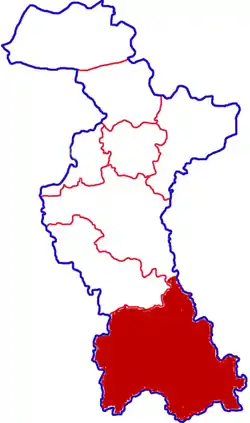
Yiyuan County (Chinese: 沂源; pinyin: Yíyuán; Wade–Giles: Iyüan) is a county in the centre of China's Shandong province and is located in the deep Tai-yi Mountains, and is the southernmost county-level division under the jurisdiction of Zibo City. It had a population of 576,000 according to the county government,[1] of which 104,200 lives in the county town. Yiyuan has the nickname of “Roof of Shandong” because of its highest average altitude among all counties within the province.[1]
History
Yiyuan county is home to a number of archaeological finds, particularly humanoid fossils.[1][2] One such fossil, referred to as the "Yiyuan ape-man fossil" is estimated to date back between 400,000 and 500,000 years ago.[2] Yiyuan people are also proud of local archeological findings from the Palæolithic and Neolithic Ages as well as cultural findings since the Shang Dynasty. The county is thought to be the setting for the famous Chinese legend of The Cowherd and the Weaver Girl.[3] It is estimated by the county government that 23,000 people from Yiyuan fought during the Japanese Invasion of China.[1] Of these 23,000 people, approximately 1,800 are thought to have died, with another 2,100 thought to be injured.[1]
Geography
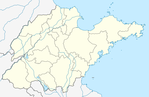
Yiyuan is located in the middle of Shandong Province, approximately 100 km (62 mi) away from Jinan and Zibo, and 170 km (110 mi) away from Qingdao. The county town is located beside one of the most important rivers in the province- the Yi River, and the name "沂源" literally means "the beginning of (the) Yi (River)".[1]
Yiyuan County is generally mountainous, with the highest peak, Lu Mountain, having an altitude of 1,108 m (3,635 ft).[1] Over 62% of the county is covered with forests, which has helped it receive a number of titles from the national government for its high marks in environmental conservation.[1]
Climate
| Climate data for Yiyuan (1991–2020 normals, extremes 1981–2010) | |||||||||||||
|---|---|---|---|---|---|---|---|---|---|---|---|---|---|
| Month | Jan | Feb | Mar | Apr | May | Jun | Jul | Aug | Sep | Oct | Nov | Dec | Year |
| Record high °C (°F) | 17.6 (63.7) |
21.5 (70.7) |
28.9 (84.0) |
33.9 (93.0) |
37.4 (99.3) |
38.3 (100.9) |
40.0 (104.0) |
37.0 (98.6) |
37.4 (99.3) |
34.2 (93.6) |
25.1 (77.2) |
19.2 (66.6) |
40.0 (104.0) |
| Mean daily maximum °C (°F) | 3.4 (38.1) |
6.9 (44.4) |
13.2 (55.8) |
20.4 (68.7) |
26.1 (79.0) |
29.6 (85.3) |
30.6 (87.1) |
29.4 (84.9) |
25.8 (78.4) |
20.0 (68.0) |
12.2 (54.0) |
5.3 (41.5) |
18.6 (65.4) |
| Daily mean °C (°F) | −2.0 (28.4) |
1.1 (34.0) |
7.0 (44.6) |
14.2 (57.6) |
20.0 (68.0) |
23.9 (75.0) |
25.9 (78.6) |
24.8 (76.6) |
20.3 (68.5) |
13.9 (57.0) |
6.4 (43.5) |
−0.1 (31.8) |
13.0 (55.3) |
| Mean daily minimum °C (°F) | −6.3 (20.7) |
−3.5 (25.7) |
1.8 (35.2) |
8.6 (47.5) |
14.2 (57.6) |
18.7 (65.7) |
22.1 (71.8) |
21.1 (70.0) |
15.8 (60.4) |
9.0 (48.2) |
1.9 (35.4) |
−4.1 (24.6) |
8.3 (46.9) |
| Record low °C (°F) | −21.4 (−6.5) |
−17.1 (1.2) |
−10.1 (13.8) |
−4.2 (24.4) |
1.4 (34.5) |
9.0 (48.2) |
14.6 (58.3) |
11.5 (52.7) |
5.0 (41.0) |
−3.6 (25.5) |
−12.5 (9.5) |
−18.9 (−2.0) |
−21.4 (−6.5) |
| Average precipitation mm (inches) | 6.6 (0.26) |
12.4 (0.49) |
13.6 (0.54) |
32.3 (1.27) |
50.0 (1.97) |
96.0 (3.78) |
197.2 (7.76) |
189.9 (7.48) |
73.6 (2.90) |
28.3 (1.11) |
25.1 (0.99) |
9.5 (0.37) |
734.5 (28.92) |
| Average precipitation days (≥ 0.1 mm) | 2.7 | 3.6 | 4.0 | 5.6 | 7.0 | 9.1 | 13.2 | 12.4 | 7.0 | 5.3 | 4.5 | 3.5 | 77.9 |
| Average snowy days | 4.1 | 3.3 | 1.6 | 0.2 | 0 | 0 | 0 | 0 | 0 | 0 | 1.4 | 2.6 | 13.2 |
| Average relative humidity (%) | 57 | 54 | 49 | 50 | 55 | 63 | 77 | 79 | 71 | 66 | 63 | 59 | 62 |
| Mean monthly sunshine hours | 159.8 | 162.2 | 210.5 | 227.0 | 249.6 | 212.2 | 178.9 | 178.6 | 185.9 | 186.6 | 161.8 | 159.1 | 2,272.2 |
| Percent possible sunshine | 51 | 52 | 56 | 58 | 57 | 49 | 40 | 43 | 51 | 54 | 53 | 53 | 51 |
| Source: China Meteorological Administration[4][5] | |||||||||||||
Administrative divisions
Yiyuan County is divided into 2 subdistricts and 10 towns.[6]
Subdistricts
The county's 2 subdistricts are Lishan Subdistrict and Nanma Subdistrict.[6]
Towns
The county's 10 towns are Lucun, Dongli, Yuezhuang, Xili, Dazhangzhuang, Zhongzhuang, Zhangjiapo, Yanya, Shiqiao, and Nanlushan.[6]
Economy
As of 2022, the county's gross domestic product (GDP) totaled 32.88 billion renminbi (RMB), a 7.3% increase from 2021.[1]
References
- 1 2 3 4 5 6 7 8 9 沂源县县情简介 [Yiyuan County County Introduction]. www.yiyuan.gov.cn. Yiyuan County People's Government. Archived from the original on 2023-09-15. Retrieved 2023-09-15.
- 1 2 "Shandong history and culture". www.china.org.cn. China Internet Information Center. 2010-03-13. Archived from the original on 2023-08-13. Retrieved 2023-09-15.
- ↑ Du, Mingming (2012-08-22). "Hometown of 'The Cowherd and the Weaving Girl': Yiyuan, Shandong". en.people.cn. People's Daily. Archived from the original on 2022-10-02. Retrieved 2023-09-15.
- ↑ 中国气象数据网 – WeatherBk Data (in Simplified Chinese). China Meteorological Administration. Retrieved 12 August 2023.
- ↑ 中国气象数据网 (in Simplified Chinese). China Meteorological Administration. Retrieved 12 August 2023.
- 1 2 3 2019年统计用区划代码 (in Chinese). National Bureau of Statistics of China. 2019. Archived from the original on 2020-09-24. Retrieved 2020-09-24.