Ziepniekkalns | |
|---|---|
Neighborhood of Riga | |
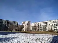
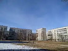 Typical inner yard in Ziepniekkalns (2022) | |
 Location in Riga | |
| Country | Latvia |
| City | Riga |
| District | Zemgale Suburb |
| Area | |
| • Total | 10.917 km2 (4.215 sq mi) |
| Population (2018) | |
| • Total | 33,016 |
| • Density | 3,000/km2 (7,800/sq mi) |
| Time zone | UTC+2 (EET) |
| • Summer (DST) | UTC+3 (EEST) |
| Website | apkaimes.lv |
Ziepniekkalns is a neighborhood of Riga, Latvia. It is located in the Pārdaugava section of Riga close to the city's southern border. Ziepniekkalns is the latest out of all Riga's neighborhoods.[1] It was built in the late 1980s and early 1990s and mostly consists of Soviet-built 10 story apartment buildings. However, there are still many older buildings in Ziepniekkalns constructed in the early 1960s. There is a major contrast between older 3 story buildings and newer 10 story ones. In the mid-1990s, route 19 trolleybus was extended to the heart of new Ziepniekkalns and now final stop is at the Mego supermarket. The trolleybus route 4 runs through the city center to Jugla.[2]
Gallery
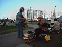 Street market in Ziepniekkalns
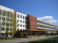 Office of perfumery and cosmetics factory Dzintars
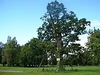 Ancient Oak Tree of Ēbelmuiža
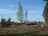 Ziepniekkalns forest
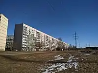 Longest apartment building in Latvia, Ozolciema street 18.
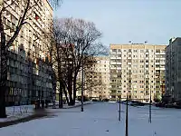 Typical inner yard in Ziepniekkalns
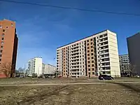
References
- ↑ "Apkaimes vēsturiskais apraksts". apkaimes.lv. 2013. Retrieved May 7, 2015.
- ↑ "Iedzīvotāju aptauja par dzīvi apkaimē 4.Ziepniekkalns" (PDF). Rīgas domes pilsētas attīstības departaments. 2013. Retrieved May 7, 2015.
Sources
- Jērāns, Pēteris (1988). Latvijas padomju enciklopēdija: Rīga. Rīga: Valērija Belokoņa izdevniecība. p. 733. ISBN 9984-9482-2-6.
56°57′N 24°00′E / 56.95°N 24°E
This article is issued from Wikipedia. The text is licensed under Creative Commons - Attribution - Sharealike. Additional terms may apply for the media files.