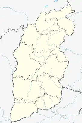
Anze County
安泽县 Antseh | |
|---|---|
 Anze Location of the seat in Shanxi | |
| Coordinates: 36°08′56″N 112°14′55″E / 36.14889°N 112.24861°E | |
| Country | People's Republic of China |
| Province | Shanxi |
| Prefecture-level city | Linfen |
| Area | |
| • Total | 1,967 km2 (759 sq mi) |
| Population (2010)[2] | |
| • Total | 82,012 |
| • Density | 42/km2 (110/sq mi) |
| Time zone | UTC+8 (China Standard) |
Anze County (simplified Chinese: 安泽县; traditional Chinese: 安澤縣; pinyin: Ānzé Xiàn) is a county in the south of Shanxi Province, China, under the administration of the prefecture-level city of Linfen.[3] The county spans an area of 1,967 square kilometers, and has a population of 82,012 as of 2010.[1][2]
History
The county was first established in 528 CE as part of the Northern Wei Dynasty.[2] In 606 CE, the county was renamed to Yueyang County (岳阳县).[2]
During the Ming Dynasty and the Qing Dynasty, the area belonged to the Pingyang Prefecture.[2]
Geography
The county's elevation ranges from 732 meters to 1,592 meters in height, with the county's highest point being Mount Antai (安太山).[3] 45.44% of Anze County's land area is forested.[1]
Climate
The county experiences an average of 2246.1 hours of sunshine annually, 539.1 millimeters of precipitation annually, 172 frost-free days annually, and an average temperature of 9.4 °C.[1]
| Climate data for Anze (1991–2019 normals, extremes 1981–2010) | |||||||||||||
|---|---|---|---|---|---|---|---|---|---|---|---|---|---|
| Month | Jan | Feb | Mar | Apr | May | Jun | Jul | Aug | Sep | Oct | Nov | Dec | Year |
| Record high °C (°F) | 16.6 (61.9) |
22.7 (72.9) |
29.4 (84.9) |
34.4 (93.9) |
37.1 (98.8) |
38.7 (101.7) |
38.7 (101.7) |
36.4 (97.5) |
36.6 (97.9) |
29.2 (84.6) |
25.2 (77.4) |
16.8 (62.2) |
38.7 (101.7) |
| Mean daily maximum °C (°F) | 3.1 (37.6) |
7.0 (44.6) |
13.3 (55.9) |
20.4 (68.7) |
25.2 (77.4) |
29.0 (84.2) |
29.8 (85.6) |
28.2 (82.8) |
23.7 (74.7) |
18.1 (64.6) |
10.9 (51.6) |
4.4 (39.9) |
17.8 (64.0) |
| Daily mean °C (°F) | −5.7 (21.7) |
−1.6 (29.1) |
4.5 (40.1) |
11.7 (53.1) |
16.8 (62.2) |
20.9 (69.6) |
23.1 (73.6) |
21.5 (70.7) |
16.3 (61.3) |
9.8 (49.6) |
2.5 (36.5) |
−3.9 (25.0) |
9.7 (49.4) |
| Mean daily minimum °C (°F) | −12.2 (10.0) |
−7.9 (17.8) |
−2.4 (27.7) |
3.9 (39.0) |
8.9 (48.0) |
13.6 (56.5) |
17.9 (64.2) |
16.8 (62.2) |
11.1 (52.0) |
3.9 (39.0) |
−3.2 (26.2) |
−9.6 (14.7) |
3.4 (38.1) |
| Record low °C (°F) | −26.6 (−15.9) |
−26.6 (−15.9) |
−15.6 (3.9) |
−9.2 (15.4) |
−3.0 (26.6) |
3.6 (38.5) |
8.6 (47.5) |
8.5 (47.3) |
−1.6 (29.1) |
−9.6 (14.7) |
−20.7 (−5.3) |
−25.0 (−13.0) |
−26.6 (−15.9) |
| Average precipitation mm (inches) | 4.7 (0.19) |
8.6 (0.34) |
11.7 (0.46) |
32.3 (1.27) |
47.7 (1.88) |
62.8 (2.47) |
137.8 (5.43) |
101.6 (4.00) |
78.1 (3.07) |
42.7 (1.68) |
20.3 (0.80) |
4.4 (0.17) |
552.7 (21.76) |
| Average precipitation days (≥ 0.1 mm) | 3.1 | 3.9 | 4.6 | 6.1 | 7.7 | 9.9 | 12.7 | 11.5 | 9.7 | 6.8 | 4.8 | 3.1 | 83.9 |
| Average snowy days | 4.1 | 5.0 | 2.7 | 0.5 | 0 | 0 | 0 | 0 | 0 | 0.1 | 2.1 | 3.3 | 17.8 |
| Average relative humidity (%) | 59 | 59 | 56 | 55 | 59 | 66 | 77 | 79 | 79 | 74 | 68 | 61 | 66 |
| Mean monthly sunshine hours | 158.4 | 156.5 | 187.3 | 212.2 | 229.8 | 211.4 | 190.2 | 178.3 | 157.2 | 168.4 | 162.3 | 161.8 | 2,173.8 |
| Percent possible sunshine | 51 | 51 | 50 | 54 | 53 | 49 | 43 | 43 | 43 | 49 | 53 | 54 | 49 |
| Source: China Meteorological Administration[4][5] | |||||||||||||
Administrative divisions
The county is divided into 4 towns and 3 townships.[3] The county government is seated in Fucheng.[3]
The county's 4 towns are Fucheng, Hechuan, Tangcheng, and Jishi.[3]
The county's 3 townships are Mabi Township, Ducun Township, and Liangma Township.[3]
Economy
Anze County has a number of natural resources, particularly coal.[1] 1,944 square kilometers of land within the county has been identified as having significant coal reserves, totaling an estimated 24 billion tons of coal.[1] Iron ore deposits within the county total an area of approximately 1.4 square kilometers, containing an estimated 1 million tons of ore.[1] Significant reserves of calcite, porcelain clay, and methane have also been discovered within Anze County.[1]
Transport
National Highway 309 and Shanxi Provincial Road 326 both run through the county.[3][1]
References
- 1 2 3 4 5 6 7 8 9 安泽简介. Anze County People's Government Web Portal (in Chinese). 2019-12-30. Archived from the original on 2020-06-30. Retrieved 2020-06-30.
- 1 2 3 4 5 6 安泽县历史沿革. xzqh.org (in Chinese). 2016-11-08. Archived from the original on 2019-05-13. Retrieved 2020-06-30.
- 1 2 3 4 5 6 7 安泽县概况地图. xzqh.org (in Chinese). 2016-10-18. Archived from the original on 2019-05-13. Retrieved 2020-06-30.
- ↑ 中国气象数据网 – WeatherBk Data (in Simplified Chinese). China Meteorological Administration. Retrieved 26 August 2023.
- ↑ 中国气象数据网 (in Simplified Chinese). China Meteorological Administration. Retrieved 26 August 2023.