Auberville-la-Manuel | |
|---|---|
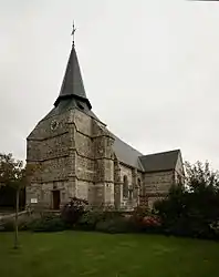 The church in Auberville-la-Manuel | |
.svg.png.webp) Coat of arms | |
Location of Auberville-la-Manuel | |
 Auberville-la-Manuel  Auberville-la-Manuel | |
| Coordinates: 49°49′43″N 0°35′22″E / 49.8286°N 0.5894°E | |
| Country | France |
| Region | Normandy |
| Department | Seine-Maritime |
| Arrondissement | Dieppe |
| Canton | Saint-Valery-en-Caux |
| Intercommunality | CC Côte Albâtre |
| Government | |
| • Mayor (2020–2026) | Maryvonne Schild[1] |
| Area 1 | 3.02 km2 (1.17 sq mi) |
| Population | 138 |
| • Density | 46/km2 (120/sq mi) |
| Time zone | UTC+01:00 (CET) |
| • Summer (DST) | UTC+02:00 (CEST) |
| INSEE/Postal code | 76032 /76450 |
| Elevation | 23–85 m (75–279 ft) (avg. 80 m or 260 ft) |
| 1 French Land Register data, which excludes lakes, ponds, glaciers > 1 km2 (0.386 sq mi or 247 acres) and river estuaries. | |
Auberville-la-Manuel is a commune in the Seine-Maritime department in the Normandy region in northern France.
Population
| Year | Pop. | ±% p.a. |
|---|---|---|
| 1968 | 207 | — |
| 1975 | 166 | −3.10% |
| 1982 | 145 | −1.91% |
| 1990 | 127 | −1.64% |
| 1999 | 103 | −2.30% |
| 2007 | 121 | +2.03% |
| 2012 | 118 | −0.50% |
| 2017 | 130 | +1.96% |
| Source: INSEE[3] | ||
See also
References
- ↑ "Répertoire national des élus: les maires". data.gouv.fr, Plateforme ouverte des données publiques françaises (in French). 9 August 2021.
- ↑ "Populations légales 2021". The National Institute of Statistics and Economic Studies. 28 December 2023.
- ↑ Population en historique depuis 1968, INSEE
Wikimedia Commons has media related to Auberville-la-Manuel.
This article is issued from Wikipedia. The text is licensed under Creative Commons - Attribution - Sharealike. Additional terms may apply for the media files.