Fontaine-sous-Préaux | |
|---|---|
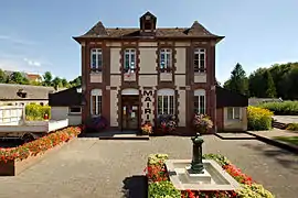 The town hall in Fontaine-sous-Préaux | |
Location of Fontaine-sous-Préaux | |
 Fontaine-sous-Préaux  Fontaine-sous-Préaux | |
| Coordinates: 49°29′07″N 1°10′08″E / 49.4853°N 1.1689°E | |
| Country | France |
| Region | Normandy |
| Department | Seine-Maritime |
| Arrondissement | Rouen |
| Canton | Darnétal |
| Intercommunality | Métropole Rouen Normandie |
| Government | |
| • Mayor (2020–2026) | Francis Debrey[1] |
| Area 1 | 3.52 km2 (1.36 sq mi) |
| Population | 563 |
| • Density | 160/km2 (410/sq mi) |
| Time zone | UTC+01:00 (CET) |
| • Summer (DST) | UTC+02:00 (CEST) |
| INSEE/Postal code | 76273 /76160 |
| Elevation | 61–158 m (200–518 ft) (avg. 80 m or 260 ft) |
| 1 French Land Register data, which excludes lakes, ponds, glaciers > 1 km2 (0.386 sq mi or 247 acres) and river estuaries. | |
Fontaine-sous-Préaux (French pronunciation: [fɔ̃tɛn su pʁeo]) is a commune in the Seine-Maritime department in the Normandy region in northern France.
Geography
A village of forestry and farming situated just 3 miles (4.8 km) northeast of the centre of Rouen, at the junction of the D47 and the D91 roads.
Population
| Year | Pop. | ±% p.a. |
|---|---|---|
| 1968 | 186 | — |
| 1975 | 263 | +5.07% |
| 1982 | 304 | +2.09% |
| 1990 | 474 | +5.71% |
| 1999 | 464 | −0.24% |
| 2007 | 559 | +2.36% |
| 2012 | 509 | −1.86% |
| 2017 | 508 | −0.04% |
| Source: INSEE[3] | ||
Places of interest
- The church of St.Pierre, dating from the nineteenth century.
See also
References
- ↑ "Répertoire national des élus: les maires" (in French). data.gouv.fr, Plateforme ouverte des données publiques françaises. 13 September 2022.
- ↑ "Populations légales 2021". The National Institute of Statistics and Economic Studies. 28 December 2023.
- ↑ Population en historique depuis 1968, INSEE
Wikimedia Commons has media related to Fontaine-sous-Préaux.
This article is issued from Wikipedia. The text is licensed under Creative Commons - Attribution - Sharealike. Additional terms may apply for the media files.