Béning-lès-Saint-Avold | |
|---|---|
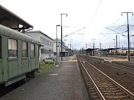 The railway station in Béning-lès-Saint-Avold | |
.svg.png.webp) Coat of arms | |
Location of Béning-lès-Saint-Avold | |
 Béning-lès-Saint-Avold  Béning-lès-Saint-Avold | |
| Coordinates: 49°07′58″N 6°50′24″E / 49.1328°N 6.84°E | |
| Country | France |
| Region | Grand Est |
| Department | Moselle |
| Arrondissement | Forbach-Boulay-Moselle |
| Canton | Freyming-Merlebach |
| Intercommunality | Freyming-Merlebach |
| Government | |
| • Mayor (2020–2026) | Simone Ramsaier[1] |
| Area 1 | 3.69 km2 (1.42 sq mi) |
| Population | 1,136 |
| • Density | 310/km2 (800/sq mi) |
| Time zone | UTC+01:00 (CET) |
| • Summer (DST) | UTC+02:00 (CEST) |
| INSEE/Postal code | 57061 /57800 |
| Elevation | 202–337 m (663–1,106 ft) |
| 1 French Land Register data, which excludes lakes, ponds, glaciers > 1 km2 (0.386 sq mi or 247 acres) and river estuaries. | |
Béning-lès-Saint-Avold (French pronunciation: [benɛ̃ lɛ sɛ̃.t‿avɔld], literally Béning near Saint-Avold; German: Beningen bei Sankt Avold) is a commune in the Moselle department in Grand Est in northeastern France.
Population
| Year | Pop. | ±% p.a. |
|---|---|---|
| 1968 | 1,203 | — |
| 1975 | 1,328 | +1.42% |
| 1982 | 1,368 | +0.42% |
| 1990 | 1,256 | −1.06% |
| 1999 | 1,231 | −0.22% |
| 2009 | 1,233 | +0.02% |
| 2014 | 1,155 | −1.30% |
| 2020 | 1,145 | −0.14% |
| Source: INSEE[3] | ||
See also
References
- ↑ "Répertoire national des élus: les maires". data.gouv.fr, Plateforme ouverte des données publiques françaises (in French). 2 December 2020.
- ↑ "Populations légales 2021". The National Institute of Statistics and Economic Studies. 28 December 2023.
- ↑ Population en historique depuis 1968, INSEE
External links
 Media related to Béning-lès-Saint-Avold at Wikimedia Commons
This article is issued from Wikipedia. The text is licensed under Creative Commons - Attribution - Sharealike. Additional terms may apply for the media files.