Porcelette | |
|---|---|
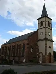 Façade of Sainte-Croix church | |
.svg.png.webp) Coat of arms | |
Location of Porcelette | |
 Porcelette  Porcelette | |
| Coordinates: 49°09′26″N 6°39′23″E / 49.1572°N 6.6564°E | |
| Country | France |
| Region | Grand Est |
| Department | Moselle |
| Arrondissement | Forbach-Boulay-Moselle |
| Canton | Saint-Avold |
| Intercommunality | CA Saint-Avold Synergie |
| Government | |
| • Mayor (2020–2026) | Alain Risch[1] |
| Area 1 | 13.44 km2 (5.19 sq mi) |
| Population | 2,472 |
| • Density | 180/km2 (480/sq mi) |
| Time zone | UTC+01:00 (CET) |
| • Summer (DST) | UTC+02:00 (CEST) |
| INSEE/Postal code | 57550 /57890 |
| Elevation | 213–342 m (699–1,122 ft) (avg. 250 m or 820 ft) |
| 1 French Land Register data, which excludes lakes, ponds, glaciers > 1 km2 (0.386 sq mi or 247 acres) and river estuaries. | |
Porcelette (French pronunciation: [pɔʁsəlɛt]; German: Porzelet) is a commune in the Moselle department in Grand Est in north-eastern France.
Population
| Year | Pop. | ±% p.a. |
|---|---|---|
| 1968 | 1,659 | — |
| 1975 | 1,918 | +2.09% |
| 1982 | 2,097 | +1.28% |
| 1990 | 2,322 | +1.28% |
| 1999 | 2,458 | +0.63% |
| 2007 | 2,467 | +0.05% |
| 2012 | 2,542 | +0.60% |
| 2017 | 2,485 | −0.45% |
| Source: INSEE[3] | ||
See also
References
- ↑ "Répertoire national des élus: les maires". data.gouv.fr, Plateforme ouverte des données publiques françaises (in French). 2 December 2020.
- ↑ "Populations légales 2021". The National Institute of Statistics and Economic Studies. 28 December 2023.
- ↑ Population en historique depuis 1968, INSEE
External links
Wikimedia Commons has media related to Porcelette.
- (in French) Official website of the commune of Porcelette.
This article is issued from Wikipedia. The text is licensed under Creative Commons - Attribution - Sharealike. Additional terms may apply for the media files.