Féy | |
|---|---|
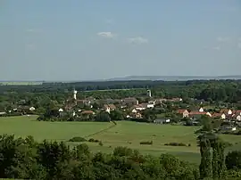 A general view of Féy | |
 Coat of arms | |
Location of Féy | |
 Féy  Féy | |
| Coordinates: 49°01′50″N 6°05′52″E / 49.0306°N 6.0978°E | |
| Country | France |
| Region | Grand Est |
| Department | Moselle |
| Arrondissement | Metz |
| Canton | Les Coteaux de Moselle |
| Intercommunality | Metz Métropole |
| Area 1 | 5.66 km2 (2.19 sq mi) |
| Population | 735 |
| • Density | 130/km2 (340/sq mi) |
| Time zone | UTC+01:00 (CET) |
| • Summer (DST) | UTC+02:00 (CEST) |
| INSEE/Postal code | 57212 /57420 |
| Elevation | 191–361 m (627–1,184 ft) (avg. 215 m or 705 ft) |
| 1 French Land Register data, which excludes lakes, ponds, glaciers > 1 km2 (0.386 sq mi or 247 acres) and river estuaries. | |
Féy (French pronunciation: [fei]; German: Buch in Lothringen) is a commune in the Moselle department in Grand Est in north-eastern France.
It lies to the south of Metz.
History
Historically, the village possessed a church (église Saint-Pierre) built in 1859 which was destroyed in 1944 during the Second World War. It has been replaced with a newer church built in a more modern style.
See also
References
- ↑ "Populations légales 2021". The National Institute of Statistics and Economic Studies. 28 December 2023.
External links
 Media related to Féy at Wikimedia Commons
This article is issued from Wikipedia. The text is licensed under Creative Commons - Attribution - Sharealike. Additional terms may apply for the media files.