Bichhiya | |
|---|---|
Village | |
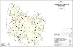 Map of Bichhiya CD block | |
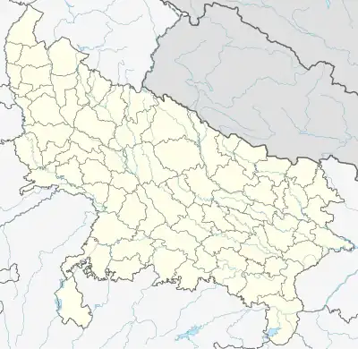 Bichhiya Location in Uttar Pradesh, India | |
| Coordinates: 26°32′N 80°37′E / 26.533°N 80.617°E[1] | |
| Country India | |
| State | Uttar Pradesh |
| District | Unnao |
| Area | |
| • Total | 3.79 km2 (1.46 sq mi) |
| Population (2011)[2] | |
| • Total | 2,347 |
| • Density | 620/km2 (1,600/sq mi) |
| Languages | |
| • Official | Hindi |
| Time zone | UTC+5:30 (IST) |
| Vehicle registration | UP-35 |
Bichhiya is a village and corresponding community development block in Unnao district of Uttar Pradesh, India.[2][1] Located about 16 km southeast of Unnao on the main road to Purwa, it also serves as the seat of a nyaya panchayat and has an Ayurvedic dispensary, a veterinary hospital, an artificial insemination centre, and a family planning centre.[1] The main crops are wheat, gram, barley, juwar, and paddy, and irrigation is largely provided by canal.[1] As of 2011, the village's population is 2,347, in 482 households.[2]
Bichhiya block was first inaugurated on 2 October 1956 in order to oversee implementation of India's Five-Year Plans at a local and rural level.[1] It is part of the tehsil of Unnao.[1][2]
Villages
Bichhiya CD block has the following 85 villages:[2]
| Village name | Total land area (hectares) | Population (in 2011) |
|---|---|---|
| Sonegarhi | 34.5 | 0 |
| Pawai | 502.6 | 2,330 |
| Mazhkoria | 491.9 | 2,145 |
| Muluk Urf Gadar | 631.8 | 3,275 |
| Chanda | 86.8 | 0 |
| Sudesh Bhadurpur | 614.9 | 2,821 |
| Mawaiya | 325.5 | 1,538 |
| Tikargarhi | 682.9 | 3,271 |
| Rupau | 966.3 | 6,914 |
| Shahpur | 137.2 | 971 |
| Sonik | 181.4 | 1,019 |
| Rampur Khalsa | 274.1 | 1,843 |
| Sindhupur | 332.8 | 1,544 |
| Algangarh | 200.7 | 1,493 |
| Sarai Katiyari | 478.1 | 3,308 |
| Sunaidha | 99.2 | 0 |
| Maita | 136.4 | 1,139 |
| Murtazanagar | 790.2 | 3,997 |
| Turkmannagar | 124.4 | 732 |
| Orhar | 1,004 | 5,513 |
| Lalpur | 104.1 | 766 |
| Gondwa Vishunpur | 302.8 | 1,331 |
| Barigawan | 61.8 | 550 |
| Lahiya | 83.7 | 360 |
| Targaon | 2,252.5 | 11,683 |
| Bichhiya (block headquarters) | 379 | 2,347 |
| Sakran | 327.6 | 1,801 |
| Devri | 76.6 | 623 |
| Hilgi | 165.3 | 131 |
| Kuithar | 364.7 | 3,384 |
| Bhandi | 146 | 1,090 |
| Ichhauli | 261.9 | 1,768 |
| Dakauli | 137.8 | 791 |
| Atesua | 57 | 608 |
| Manya | 37.9 | 533 |
| Atarsa | 249.8 | 1,319 |
| Dherua | 94.3 | 313 |
| Mau Sultanpur | 397.6 | 2,814 |
| Paharpur | 57.1 | 244 |
| Ghurkhet | 932.5 | 2,343 |
| Badlikhera | 421.9 | 1,501 |
| Taura | 1,145.7 | 5,903 |
| Pathakpur | 25.8 | 130 |
| Khargikhera | 56 | 394 |
| Jar Gaon | 777.1 | 3,867 |
| Meerpur | 47 | 153 |
| Bhatkherwa | 80.7 | 267 |
| Jagetha | 199.7 | 1,136 |
| Paungha | 158.3 | 540 |
| Gauri Shankerpur Grant | 167.3 | 911 |
| Tiwari Khera | 116.5 | 569 |
| Padri Khurd | 1,019 | 3,630 |
| Neverna | 1,471 | 7,572 |
| Padri Kalan | 1,404.4 | 6,216 |
| Shivpur | 312.2 | 1,635 |
| Raipur Satan | 206.6 | 995 |
| Maroi | 458 | 978 |
| Godwa Bhimma | 102.7 | 685 |
| Jamuka | 675 | 4,288 |
| Chausadha | 191.7 | 737 |
| Badaura | 442.9 | 2,170 |
| Gohna | 196.8 | 1,071 |
| Aderwa Khas | 482.7 | 2,824 |
| Shivpur Grant | 166.5 | 542 |
| Mohiuddeenpur Khas | 252.9 | 1,818 |
| Etauli | 542.8 | 2,629 |
| Potriha | 516 | 4,324 |
| Mugalpur | 122.5 | 466 |
| Korari Kalan | 1,291.4 | 9,092 |
| Korari Khurd | 79.1 | 1,639 |
| Amarsus | 236.3 | 2,673 |
| Daulatpur | 119.3 | 754 |
| Behta | 321.2 | 3,144 |
| Jhajhari | 154.1 | 1,240 |
| Wajidpur Urf Rajepur | 274.7 | 558 |
| Ganjauli | 326 | 3,050 |
| Chandpur | 1,906.5 | 1,897 |
| Nandauli | 303.1 | 636 |
| Raipur Bujurg | 615.6 | 2,760 |
| Husain Nagar | 805.2 | 5,337 |
| Gadan Khera | 199.3 | 2,070 |
| Kotra | 114.8 | 1,238 |
| Chitlapur | 138.2 | 965 |
| Deeh | 1,066.6 | 8,194 |
| Dua | 267.3 | 2,174 |
References
- 1 2 3 4 5 6 Baghel, Amar Singh (1979). Uttar Pradesh District Gazetteers: Unnao. Rampur: Government Press. pp. 150–2, 256. Retrieved 6 July 2021.
- 1 2 3 4 5 6 "Census of India 2011: Uttar Pradesh District Census Handbook - Unnao, Part A (Village and Town Directory)". Census 2011 India. pp. 280-. Retrieved 6 July 2021.