Bihar
Bihār | |
|---|---|
Village | |
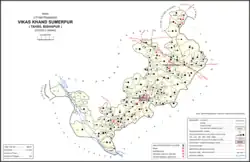
 Map showing Bihar (#850) in Sumerpur CD block | |
 Bihar Location in Uttar Pradesh, India | |
| Coordinates: 26°17′10″N 80°49′47″E / 26.285985°N 80.829623°E[1] | |
| Country India | |
| State | Uttar Pradesh |
| District | Unnao |
| Area | |
| • Total | 6.226 km2 (2.404 sq mi) |
| Population (2011)[2] | |
| • Total | 5,952 |
| • Density | 960/km2 (2,500/sq mi) |
| Languages | |
| • Official | Hindi |
| Time zone | UTC+5:30 (IST) |
| Vehicle registration | UP-35 |
Bihar is a village in Sumerpur block of Unnao district, Uttar Pradesh, India.[2] Located on the main Unnao-Raebareli road, just to the east of the Loni river and near its confluence with the Kharahi, Bihar was briefly the headquarters of a tehsil in Raebareli district from 1860 until 1862, when it was moved into Unnao district.[3] As of 2011, the population of Bihar is 5,952, in 1,088 households, and it has 5 primary schools and no healthcare facilities.[2]
History
According to tradition, Bihar was founded by Birbhan, ancestor of the Bais taluqdars of Patan-Bihar, and named "Birhar" after himself.[3] More realistically, the name was probably derived from a vihara or Buddhist monastery.[3] Bihar was made the seat of a pargana under the Mughal emperor Akbar.[3] At some point during the 1700s, it was the site of a battle between the Raos of Daundia Khera, the Raja of Maurawan, and the chief of Shankarpur, all from the Bais clan.[3] It was chosen as the seat of a tehsil by the British in 1860, but when it was moved into Unnao district two years later the tehsil was dissolved and Bihar was put under Purwa tehsil instead.[3]
At the turn of the 20th century, Bihar was described as a small town with several historical monuments, surrounded by a rich agricultural countryside.[3] There had previously been two marketplaces, Radhaganj and Durgaganj, but Durgaganj had not held a market since the Indian Rebellion of 1857 and had fallen into disrepair.[3] Radhaganj, which had been built by the taluqdar Shiudin Singh in 1846 and named after the goddess Radha, held markets on Wednesdays and Saturdays.[3] Shiudin Singh had also built a temple to Radha in Bihar.[3] The fair held in honour of Biddhia Dhar had an average attendance of about 14,000 people then.[3] A masonry tank was built in 1862 by Ikram-ullah, who was a tehsildar of Bihar, and financed in part by a subscription collected from the taluqdars.[3] Near the old tehsil buildings, there was also a mud-built sarai, and to the south of the Rae Bareli road were the ruins of an old fort.[3] There was a police station and a middle vernacular school with 106 students.[3] The population of Bihar in 1901 was 1,853, including a Muslim minority of 147.[3]
The 1961 census recorded Bihar as comprising 9 hamlets, with a total population of 2,278 (1,027 male and 1,251 female), in 535 households and 450 physical houses.[4] The area of the village was given as 1,557 acres, and it had a post office at the time.[4] Bihar then had the following small industrial establishments: 2 places producing edible fats/oils, 4 miscellaneous food processing establishments, 2 garment manufacturers, 1 place making shoes, 4 makers of sundry hardwares, 1 bicycle repair shop, and 1 maker of jewellery or precious metal objects.[4]
Culture
Bihar holds a fair in honour of Biddia Dhar, a Hindu faqir who died in the village of Bakra Khurd.[3] Arjun Singh, the taluqdar of Patan-Bihar, had been a follower of his, and he had his kundi (i.e. mortar and pestle buried at Bihar and had a platform raised on the site in his honour.[3] The fair takes place during the month of Pus (i.e. December and January), and vendors bring various items including cloth, brass, copper, iron utensils, and gur.[3]
References
- ↑ "Do a radial search using these coordinates here".
- 1 2 3 4 "Census of India 2011: Uttar Pradesh District Census Handbook - Unnao, Part A (Village and Town Directory)". Census 2011 India. pp. 416–41. Retrieved 12 July 2021.
- 1 2 3 4 5 6 7 8 9 10 11 12 13 14 15 16 17 18 Nevill, H.R. (1903). Unao: A Gazetteer, Being Volume XXXVIII Of The District Gazetteers Of The United Provinces Of Agra And Oudh. Allahabad: Government Press. pp. 163–6. Retrieved 12 July 2021.
- 1 2 3 Census 1961: District Census Handbook, Uttar Pradesh (37 - Unnao District) (PDF). Lucknow. 1965. pp. cxiv-cxv of section "Purwa Tehsil", cxxvi–cxxvii. Retrieved 9 July 2021.
{{cite book}}: CS1 maint: location missing publisher (link)