Rasulpur
Rasūlpur | |
|---|---|
Village | |
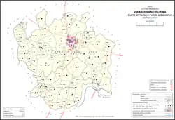 Map showing Rasulpur (#815) in Purwa CD block | |
 Rasulpur Location in Uttar Pradesh, India | |
| Coordinates: 26°21′03″N 80°45′49″E / 26.35094°N 80.763645°E[1] | |
| Country India | |
| State | Uttar Pradesh |
| District | Unnao |
| Area | |
| • Total | 1.277 km2 (0.493 sq mi) |
| Population (2011)[2] | |
| • Total | 617 |
| • Density | 480/km2 (1,300/sq mi) |
| Languages | |
| • Official | Hindi |
| Time zone | UTC+5:30 (IST) |
| Vehicle registration | UP-35 |
Rasulpur is a village in Purwa block of Unnao district, Uttar Pradesh, India.[2] As of 2011, its population is 617, in 118 households, and it has no schools and no healthcare facilities.[2]
The 1961 census recorded Rasulpur as comprising 1 hamlet, with a total population of 230 (136 male and 94 female), in 20 households and 20 physical houses.[3] The area of the village was given as 323 acres.[3]
References
- ↑ "GeoNames Search". geonames.nga.mil. Archived from the original on 12 April 2014. Retrieved 17 August 2023.
- 1 2 3 4 "Census of India 2011: Uttar Pradesh District Census Handbook - Unnao, Part A (Village and Town Directory)". Census 2011 India. pp. 348–72. Retrieved 12 July 2021.
- 1 2 Census 1961: District Census Handbook, Uttar Pradesh (37 - Unnao District) (PDF). Lucknow. 1965. pp. cvi-cvii of section "Purwa Tehsil". Retrieved 11 July 2021.
{{cite book}}: CS1 maint: location missing publisher (link)
This article is issued from Wikipedia. The text is licensed under Creative Commons - Attribution - Sharealike. Additional terms may apply for the media files.