Caibaté | |
|---|---|
Municipality | |
 Flag  Coat of arms | |
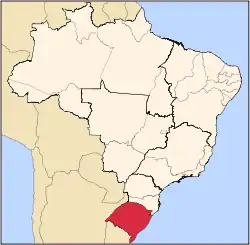
 Location in Rio Grande do Sul state | |
 Caibaté Location in Brazil | |
| Coordinates: 28°17′16″S 54°38′16″W / 28.28778°S 54.63778°W | |
| Country | |
| State | Rio Grande do Sul |
| Area | |
| • Total | 259.66 km2 (100.26 sq mi) |
| Elevation | 286 m (938 ft) |
| Population (2020 [1]) | |
| • Total | 4,823 |
| • Density | 19/km2 (48/sq mi) |
| Time zone | UTC−3 (BRT) |
| Postal code | 97930-xxx |
| Website | www |
Caibaté is a municipality of the state of Rio Grande do Sul, Brazil. The population is 4,823 (2020 est.) in an area of 259.66 km².[2] The name comes from the Tupi language. It is located 524 km west of the state capital of Porto Alegre, northeast of Alegrete.
Bounding municipalities
References
External links
This article is issued from Wikipedia. The text is licensed under Creative Commons - Attribution - Sharealike. Additional terms may apply for the media files.