Ponte Preta, Rio Grande do Sul | |
|---|---|
 View of Ponte Preta, Rio Grande do Sul | |
 Flag  Seal | |
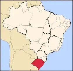
 Location of Ponte Preta within Rio Grande do Sul | |
| Coordinates: 27°39′14″S 52°29′16″W / 27.65389°S 52.48778°W | |
| Country | Brazil |
| State | Rio Grande do Sul |
| Mesoregion | Noroeste Rio-Grandense |
| Microregion | Microregion of Erechim |
| Government | |
| • Mayor | Luis Carlos Parise |
| Area | |
| • Total | 100.407 km2 (38.767 sq mi) |
| Population (2020 [1]) | |
| • Total | 1,524 |
| • Density | 19.6/km2 (51/sq mi) |
| Time zone | UTC−3 (BRT) |
| HDI | 0.782 (UNDP 2000) |
| GDP | R$ 20,210,994.00 (IBGE 2003) |
| GDP per capita | R$ 10,135.91 (IGBE 2003) |
Ponte Preta is a municipality in the state of Rio Grande do Sul, Brazil. In 2020 it had an estimated population of 1,524.
References
This article is issued from Wikipedia. The text is licensed under Creative Commons - Attribution - Sharealike. Additional terms may apply for the media files.