Central Buton Regency
Kabupaten Buton Tengah | |
|---|---|
 Coat of arms | |
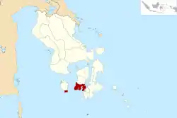 Location within Southeast Sulawesi | |
| Coordinates: 5°18′41″S 122°27′24″E / 5.311493°S 122.456664°E | |
| Country | Indonesia |
| Province | Southeast Sulawesi |
| Established | 24 July 2014[1] |
| Founded by | Government of Indonesia |
| Capital | Labungkari |
| Government | |
| • Regent | Samahuddin |
| • Vice Regent | La Ntau |
| Area | |
| • Total | 837.16 km2 (323.23 sq mi) |
| Population (mid 2022 estimate)[2] | |
| • Total | 118,904 |
| • Density | 140/km2 (370/sq mi) |
| Time zone | UTC+8 (ICST) |
| Area code | (+62) 402 |
| Website | butontengahkab |

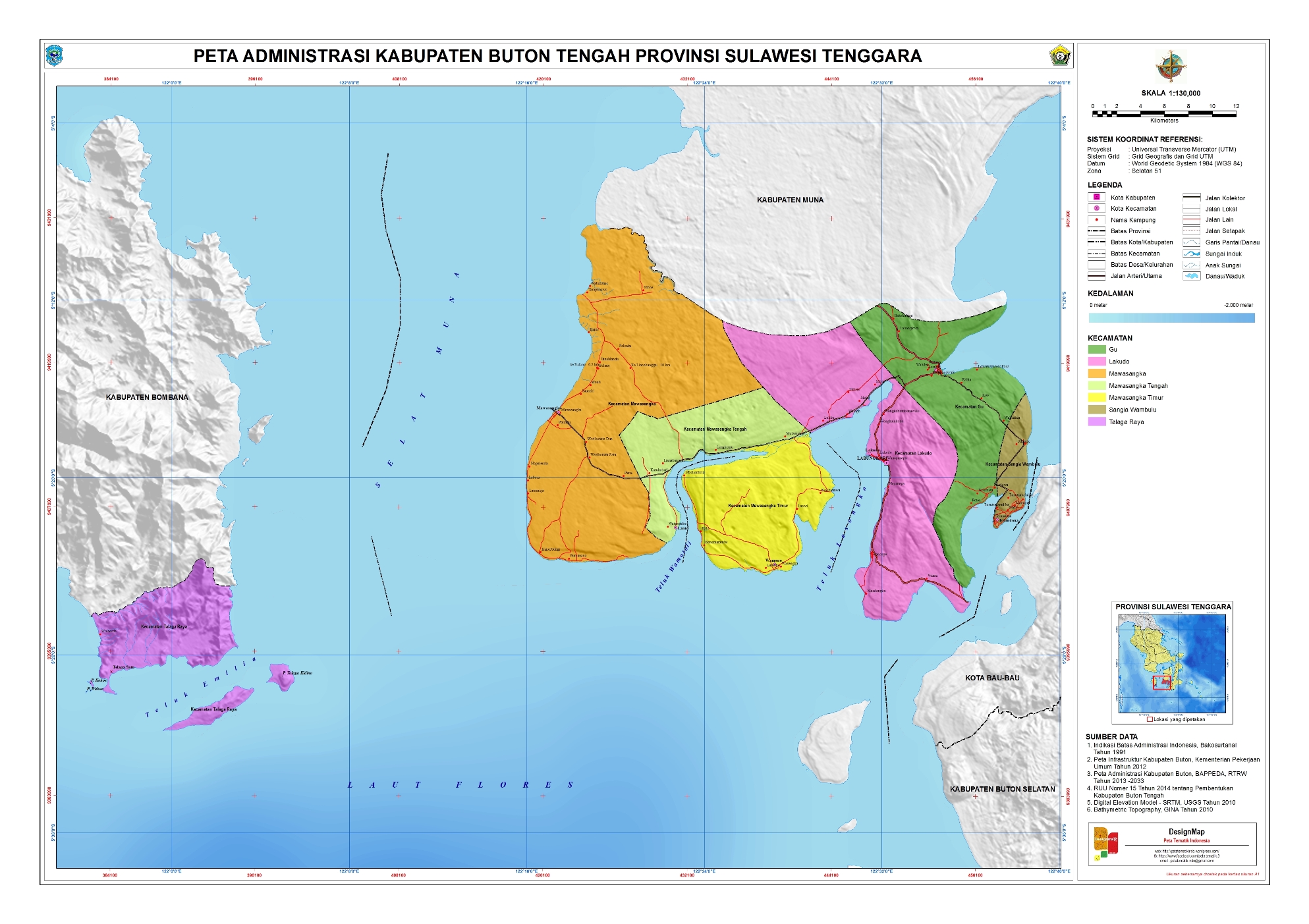
Central Buton Regency (Indonesian: Kabupaten Buton Tengah) is a new regency of Southeast Sulawesi established by separation from Buton Regency under Act No.15 of 2014, dated 23 July 2014. It covers an area of 837.16 km2 comprising the southern parts of Muna Island and Kabaena Island, together with several small offshore islands adjacent to the two main islands, with no territory located on Buton Island (a misnomer). It had a population of 86,112 at the 2010 Census[3] and 114,773 at the 2020 Census;[4] the official estimate as at mid 2022 was 118,904 (comprising 59,419 males and 59,485 females).[2] The administrative centre lies at Labungkari in Lakudo District.[5]
Administrative districts
The Central Buton Regency is divided into seven districts (kecamatan),[6][7] tabulated below with their areas and 2010[3] and 2020 Census[4] populations, together with the official estimates as at mid 2022.[2] The table also includes the location of the administrative centre of each district, the number of administrative villages in each district (totaling 67 rural desa and 10 urban kelurahan), the number of small offshore islands in each district, and its post code.
| Kode Wilayah | Name of District (kecamatan) | Area in km2 | Pop'n Census 2010 | Pop'n Census 2020 | Pop'n Estimate mid 2022 | Admin centre | No. of villages | No. of islands | Post code |
|---|---|---|---|---|---|---|---|---|---|
| 74.14.04 | Mawasangka | 229.02 | 22,054 | 28,985 | 29,940 | Mawasangka | 19 (a) | 1 | 93762 |
| 74.14.03 | Mawasangka Tengah (Central Mawasangka) | 121.99 | 9,147 | 12,717 | 13,280 | Lanto | 10 (b) | 6 | 93764 |
| 74.14.02 | Mawasangka Timur (East Mawasangka) | 93.35 | 4,839 | 6,130 | 6,287 | Lasori | 8 | 6 | 93765 |
| 74.14.01 | Lakudo | 204.30 | 20,210 | 26,556 | 27,430 | Lakudo | 15 (c) | 3 | 93763 |
| 74.14.06 | Gu | 93.10 | 15,836 | 21,540 | 22,398 | Watulea | 12 (a) | - | 93761 |
| 74.14.07 | Sangia Wambulu | 5.91 | 5,003 | 5,903 | 5,972 | Tolandona | 6 (b) | - | 93760 |
| 74.14.05 | Talaga Raya (d) | 89.49 | 9,023 | 12,942 | 13,597 | Talaga Satu | 7 (b) | 5 | 93766 |
| Totals | 837.16 | 86,112 | 114,773 | 118,904 | 77 | 21 |
The new Regency thus comprises six districts in the southern part of Muna Island together with one district (Talaga Raya) in the southern part of Kabaena Island. It notably does not contain any portion of Buton Island.
Note: (a) includes 2 kelurahan. (b) includes one kelurahan. (c) includes 3 kelurahan.
(d) Talaga Raya District comprises the southern part of Kabaena Island together with two smaller islands off its south-east coast - Talaga Besar (Great Talaga) and Talaga Kecil (Little Talaga); over 60% of the district's population inhabit Talaga Kecil, which contained 7,836 inhabitants (at the 2020 Census) in its area of 3.29 km2.
References
- ↑ "Pembentukan Kabupaten Buton Tengah Di Provinsi Sulawesi Tenggara" (PDF) (in Indonesian). Government of Indonesia.
- 1 2 3 Badan Pusat Statistik, Jakarta, 2023, Kabupaten Buton Tengah Dalam Angka 2023 (Katalog-BPS 1102001.7414)
- 1 2 Biro Pusat Statistik, Jakarta, 2011.
- 1 2 Badan Pusat Statistik, Jakarta, 2021.
- ↑ "UNDANG-UNDANG REPUBLIK INDONESIA NOMOR 15 TAHUN 2014 PEMBENTUKAN KABUPATEN BOTON TENGAH DI PROVINSI SULAWESI TENGGARA" (in Indonesian). Government of Indonesia.
- ↑ "Pembagian Administrasi Kabupaten Buton Tengah" (in Indonesian). BPK Kendari.
- ↑ "Pembagian Administrasi Kabupaten Buton Tengah" (in Indonesian). Peta Tematik Indonesia.
External links
Regencies and cities of Southeast Sulawesi | ||
|---|---|---|
Capital: Kendari | ||
| Regencies | ||
| Cities | ||