North Kolaka Regency
Kabupaten Kolaka Utara | |
|---|---|
 Seal | |
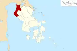 Location within Southeast Sulawesi | |
| Coordinates: 3°20′14″S 121°02′38″E / 3.33722°S 121.04389°E | |
| Country | Indonesia |
| Province | Southeast Sulawesi |
| Anniversary | 7 January 2004 |
| Capital | Lasusua |
| Government | |
| • Regent | Nur Rahman Umar |
| • Vice Regent | Abass |
| Area | |
| • Total | 2,924.46 km2 (1,129.14 sq mi) |
| Population (mid 2022 estimate)[1] | |
| • Total | 141,151 |
| • Density | 48/km2 (130/sq mi) |
| Time zone | UTC+8 (ICST) |
| Area code | (+62) 405 |
| Website | kolutkab |

North Kolaka Regency is a regency in the northwest part of Southeast Sulawesi province of Indonesia. It covers an area of 2,924.46 km2,[2] and had a population of 121,476 at the 2010 Census,[3] and 137,700 at the 2020 Census;[4] the official estimate as at mid 2022 was 141,151 - comprising 72,089 males and 69,062 females.[1] The principal town lies at Lasusua.
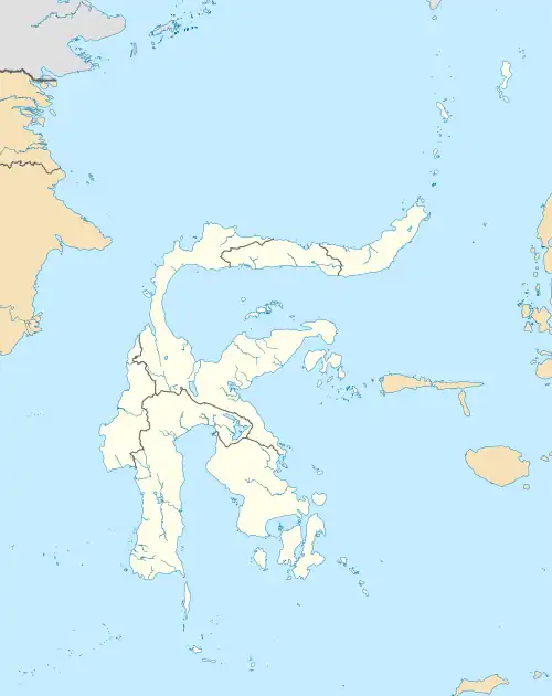
Administration
The North Kolaka Regency is divided into fifteen districts (kecamatan), tabulated below from south to north, with their areas (as given by the regency BPS) and their populations at the 2010 Census[3] and the 2020 Census,[4] together with the official estimates as at mid 2022.[1] The table also includes the location of the district administrative centres and the number of villages in each district (totalling 133 - comprising 127 rural desa and 6 urban kelurahan).
| Kode Wilayah | Name of District (kecamatan) | Area in km2 | Pop'n Census 2010 | Pop'n Census 2020 | Pop'n Estimate mid 2022 | Admin centre | No. of villages |
|---|---|---|---|---|---|---|---|
| 74.08.07 | Wawo | 260.96 | 5,615 | 6,805 | 7,052 | Wawo | 7 |
| 74.08.08 | Lambai | 97.97 | 5,308 | 6,370 | 6,589 | Lambai | 7 |
| 74.08.04 | Rante Angin | 83.35 | 5,301 | 5,951 | 6,077 | Rante Angin | 7 * |
| 74.08.01 | Lasusua | 269.32 | 21,756 | 27,249 | 28,418 | Lasusua | 12 * |
| 74.08.13 | Katoi | 144.49 | 5,763 | 6,930 | 7,171 | Katoi | 6 |
| 74.08.05 | Kodeoha | 137.26 | 10,644 | 11,259 | 11,385 | Mala-Mala | 12 * |
| 74.08.14 | Tiwu | 35.47 | 4,042 | 4,553 | 4,652 | Tiwu | 7 |
| 74.08.06 | Ngapa | 222.71 | 17,355 | 17,284 | 17,341 | Lapai | 12 * |
| 74.08.09 | Watunohu | 33.40 | 6,212 | 6,713 | 6,804 | Watunohu | 8 |
| 74.08.02 | Pakue | 150.68 | 9,345 | 10,301 | 10,481 | Olo-Oloho | 11 * |
| 74.08.10 | Pakue Tengah (Central Pakue) | 174.47 | 6,132 | 7,489 | 7,773 | Latali | 10 |
| 74.08.11 | Pakue Utara (North Pakue) | 223.80 | 6,966 | 8,048 | 8,264 | Pakue | 9 |
| 74.08.03 | Batu Putih | 236.56 | 7,372 | 8,512 | 8,739 | Batu Putih | 11 * |
| 74.08.12 | Porehu | 571.60 | 6,936 | 6,704 | 6,733 | Porehu | 8 |
| 74.08.15 | Tolala | 282.42 | 2,593 | 3,491 | 3,692 | Tolala | 6 |
| Totals | 2,924.46 | 121,476 | 137,659 | 141,151 | Lasusua | 133 |
Note that an asterisk in the final column indicates the number includes one kelurahan (in each case with the same name as the district administrative centre).
Climate
Lasusua, the seat of the regency has a tropical rainforest climate (Af) with moderate rainfall in October and November and heavy to very heavy rainfall in the remaining months.
| Climate data for Lasusua | |||||||||||||
|---|---|---|---|---|---|---|---|---|---|---|---|---|---|
| Month | Jan | Feb | Mar | Apr | May | Jun | Jul | Aug | Sep | Oct | Nov | Dec | Year |
| Mean daily maximum °C (°F) | 30.6 (87.1) |
30.7 (87.3) |
30.9 (87.6) |
31.1 (88.0) |
30.9 (87.6) |
30.2 (86.4) |
30.0 (86.0) |
30.8 (87.4) |
31.5 (88.7) |
32.3 (90.1) |
31.9 (89.4) |
31.1 (88.0) |
31.0 (87.8) |
| Daily mean °C (°F) | 26.8 (80.2) |
27.0 (80.6) |
27.1 (80.8) |
27.2 (81.0) |
27.2 (81.0) |
26.4 (79.5) |
26.0 (78.8) |
26.3 (79.3) |
26.8 (80.2) |
27.4 (81.3) |
27.6 (81.7) |
27.2 (81.0) |
26.9 (80.5) |
| Mean daily minimum °C (°F) | 23.1 (73.6) |
23.3 (73.9) |
23.3 (73.9) |
23.3 (73.9) |
23.5 (74.3) |
22.7 (72.9) |
22.0 (71.6) |
21.9 (71.4) |
22.1 (71.8) |
22.6 (72.7) |
23.3 (73.9) |
23.3 (73.9) |
22.9 (73.1) |
| Average rainfall mm (inches) | 158 (6.2) |
169 (6.7) |
191 (7.5) |
238 (9.4) |
361 (14.2) |
298 (11.7) |
228 (9.0) |
192 (7.6) |
177 (7.0) |
123 (4.8) |
118 (4.6) |
137 (5.4) |
2,390 (94.1) |
| Source: Climate-Data.org[5] | |||||||||||||
Villages
References
- 1 2 3 Badan Pusat Statistik, Jakarta, 2023, Kabupaten Kolaka Utara Dalam Angka 2023 (Katalog-BPS 1102001.7408)
- ↑ This is the figure recorded by the regency BPS; the figure quoted by the province BPS is 3,391.67 km2.
- 1 2 Biro Pusat Statistik, Jakarta, 2011.
- 1 2 Badan Pusat Statistik, Jakarta, 2021.
- ↑ "Climate: Lasusua". Climate-Data.org. Retrieved 22 November 2020.
Regencies and cities of Southeast Sulawesi | ||
|---|---|---|
Capital: Kendari | ||
| Regencies | ||
| Cities | ||