Clermont Township | |
|---|---|
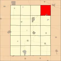 Location in Fayette County | |
| Coordinates: 43°02′14″N 91°39′45″W / 43.03722°N 91.66250°W | |
| Country | |
| State | |
| County | Fayette |
| Area | |
| • Total | 36.34 sq mi (94.11 km2) |
| • Land | 36.34 sq mi (94.11 km2) |
| • Water | 0 sq mi (0 km2) 0% |
| Elevation | 1,037 ft (316 m) |
| Population (2010) | |
| • Total | 894 |
| • Density | 25/sq mi (9.5/km2) |
| Time zone | UTC-6 (CST) |
| • Summer (DST) | UTC-5 (CDT) |
| ZIP codes | 52133, 52135, 52162 |
| GNIS feature ID | 0467622 |
Clermont Township is one of twenty townships in Fayette County, Iowa, USA. As of the 2010 census, its population was 894.[1]
Geography
According to the United States Census Bureau, Clermont Township covers an area of 36.34 square miles (94.11 square kilometers).
Cities, towns, villages
Adjacent townships
- Bloomfield Township, Winneshiek County (north)
- Post Township, Allamakee County (northeast)
- Grand Meadow Township, Clayton County (east)
- Marion Township, Clayton County (southeast)
- Pleasant Valley Township (south)
- Union Township (southwest)
- Dover Township (west)
Cemeteries
The township contains Saint Peters Cemetery.
Major highways
Airports and landing strips
- Dale Delight Airport
School districts
- Postville Community School District
- North Fayette Valley Community School District
Political districts
- Iowa's 1st congressional district
- State House District 18
- State Senate District 9
References
External links
Municipalities and communities of Fayette County, Iowa, United States | ||
|---|---|---|
| Cities | Map of Iowa highlighting Fayette County | |
| Townships | ||
| Unincorporated communities | ||
| Footnotes | ‡This populated place also has portions in an adjacent county or counties | |
This article is issued from Wikipedia. The text is licensed under Creative Commons - Attribution - Sharealike. Additional terms may apply for the media files.