Dover Township | |
|---|---|
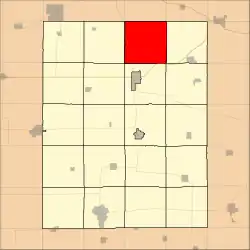 Location in Fayette County | |
| Coordinates: 43°02′17″N 91°46′43″W / 43.03806°N 91.77861°W | |
| Country | |
| State | |
| County | Fayette |
| Area | |
| • Total | 37.33 sq mi (96.68 km2) |
| • Land | 37.33 sq mi (96.68 km2) |
| • Water | 0 sq mi (0 km2) 0% |
| Elevation | 965 ft (294 m) |
| Population (2010) | |
| • Total | 465 |
| • Density | 12/sq mi (4.8/km2) |
| Time zone | UTC-6 (CST) |
| • Summer (DST) | UTC-5 (CDT) |
| ZIP codes | 52133, 52135, 52141, 52161, 52175 |
| GNIS feature ID | 0467739 |
Dover Township is one of twenty townships in Fayette County, Iowa, USA. As of the 2010 census, its population was 465.[1]
Geography
According to the United States Census Bureau, Dover Township covers an area of 37.33 square miles (96.68 square kilometers).
Unincorporated towns
- Dover Mills at 43°01′10″N 91°43′46″W / 43.019423°N 91.729323°W
- Eldorado at 43°03′02″N 91°50′08″W / 43.050532°N 91.835439°W
(This list is based on USGS data and may include former settlements.)
Adjacent townships
- Military Township, Winneshiek County (north)
- Bloomfield Township, Winneshiek County (northeast)
- Clermont Township (east)
- Pleasant Valley Township (southeast)
- Union Township (south)
- Windsor Township (southwest)
- Auburn Township (west)
- Washington Township, Winneshiek County (northwest)
Cemeteries
The township contains these six cemeteries: Auburn Township, Bethany, Dover Township, George, Nutting and Saint Peter.
Major highways
Landmarks
- Dutton Cave County Park
- Goeken County Park
School districts
- North Fayette Valley Community School District
Political districts
- Iowa's 1st congressional district
- State House District 18
- State Senate District 9
References
External links
Municipalities and communities of Fayette County, Iowa, United States | ||
|---|---|---|
| Cities | Map of Iowa highlighting Fayette County | |
| Townships | ||
| Unincorporated communities | ||
| Footnotes | ‡This populated place also has portions in an adjacent county or counties | |
This article is issued from Wikipedia. The text is licensed under Creative Commons - Attribution - Sharealike. Additional terms may apply for the media files.