| Croghan Mountain | |
|---|---|
| Cruachán Uí Chinnsealaigh | |
 Croghan, and Croghan East Top, in snow as viewed from Kilcavan, County Wicklow | |
| Highest point | |
| Elevation | 606 m (1,988 ft)[1] |
| Prominence | 520 m (1,710 ft)[1] |
| Listing | Hewitt, Marilyn, Arderin, Simm, Vandeleur-Lynam |
| Coordinates | 52°48′N 6°19′W / 52.800°N 6.317°W |
| Naming | |
| English translation | little stack of Kinsella |
| Language of name | Irish |
| Geography | |
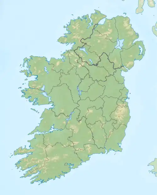
 Croghan Mountain Location in Ireland | |
| Location | Wicklow/Wexford border, Ireland |
| Parent range | Wicklow Mountains |
| OSI/OSNI grid | T1309672884 |
| Topo map | OSi Discovery 62 |
| Geology | |
| Type of rock | Basalt and gabbro[1] |
Croghan Mountain or Croghan Kinsella (Irish: Cruachán Uí Chinnsealaigh, meaning 'little stack of the Kinsella family')[2] at 606 metres (1,988 ft), is the 211th–highest peak in Ireland on the Arderin scale,[3] and the 258th–highest peak on the Vandeleur-Lynam scale.[4][5] Croghan is situated at the far southeastern end of the Wicklow Mountains on the Wicklow and Wexford border, in Ireland.[5]
Naming
The fuller name comes from the Uí Chinnsealaigh, who were the dominant gaelic family in the area; and is used to differentiate it from other "Cruachan" mountains.[2][6]
Geography
Croghan is situated at the far southeastern end of the Wicklow Mountains on the Wicklow and Wexford border, in Ireland.[5] Croghan is separated from the main range on its own small massif that includes neighbouring Croghan East Top 562 metres (1,844 ft) (which gives Croghan the profile of a "double peak"), and Slievefoore 414 metres (1,358 ft) to the east. Croghan is the source of the River Bann with rises from its southern slopes.[5]
Raheenleagh Wind Farm
The eastern side of Croghan contains the Raheenleagh Wind Farm, which was a 32.2 MW Coillte-ESB Group joint venture project that opened on 20 September 2016.[7] The wind farm was constructed in an existing Coillte forest, and consists of 11 Siemens Wind Power (108 – DD – 3.2MW) wind turbines.[7] The project received planning permission in 2012, and a 17-month construction process started in mid-2015.[7]
In 2018, it was reported that Coillte had sold their 50 percent stake to Greencoat Renewables.[8]
Bibliography
- MountainViews Online Database (Simon Stewart) (2013). A Guide to Ireland's Mountain Summits: The Vandeleur-Lynams & the Arderins. Collins Books. ISBN 978-1-84889-164-7.
See also
References
- 1 2 3 "Crogan Mountain". Peakbagger. Retrieved 15 March 2023.
- 1 2 Paul Tempan (February 2012). "Irish Hill and Mountain Names" (PDF). MountainViews.ie.
- ↑ Simon Stewart (October 2018). "Arderins: Irish mountains of 500+m with a prominence of 30m". MountainViews Online Database.
- ↑ Simon Stewart (October 2018). "Vandeleur-Lynams: Irish mountains of 600+m with a prominence of 15m". MountainViews Online Database.
- 1 2 3 4 Mountainviews, (September 2013), "A Guide to Ireland's Mountain Summits: The Vandeleur-Lynams & the Arderins", Collins Books, Cork, ISBN 978-1-84889-164-7
- ↑ Brendan Bracken (6 March 2010). "Go Walk: Raheenleagh Wood to Croghan Mountain, Co Wexford/Co Wicklow". Irish Times. Retrieved 25 July 2019.
- 1 2 3 "About the Raheenleagh Wind Farm Project". Raheenleagh Wind Farm. Retrieved 25 July 2019.
- ↑ Joe Brennan (11 September 2018). "State to share in €136m Coillte will earn from sale of its stake in four wind farms". Irish Times. Retrieved 25 July 2019.
External links
- MountainViews: The Irish Mountain Website, Croghan (or Croghan Kinsella)
- MountainViews: Irish Online Mountain Database
- The Database of British and Irish Hills , the largest database of British Isles mountains ("DoBIH")
- Hill Bagging UK & Ireland, the searchable interface for the DoBIH


.jpg.webp)
