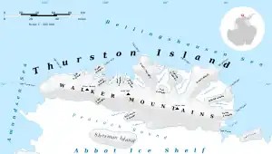
Map of Thurston Island.
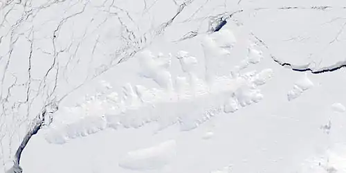
Satellite image of Thurston Island.
Dickens Peak (72°8′S 99°19′W / 72.133°S 99.317°W) is a peak 1.5 nautical miles (3 km) north-northwest of Smith Peak in the Walker Mountains of north-central Thurston Island. It was named by the Advisory Committee on Antarctic Names after Aviation Machinist's Mate J.D. Dickens, an aircrewman in the Eastern Group of U.S. Navy Operation Highjump, which obtained aerial photographs of this peak and adjacent coastal areas, 1946–47.[1]
See also
Maps
- Thurston Island – Jones Mountains. 1:500000 Antarctica Sketch Map. US Geological Survey, 1967.
- Antarctic Digital Database (ADD). Scale 1:250000 topographic map of Antarctica. Scientific Committee on Antarctic Research (SCAR), 1993–2016.
References
- ↑ "Dickens Peak". Geographic Names Information System. United States Geological Survey, United States Department of the Interior. Retrieved 19 January 2012.
![]() This article incorporates public domain material from "Dickens Peak". Geographic Names Information System. United States Geological Survey.
This article incorporates public domain material from "Dickens Peak". Geographic Names Information System. United States Geological Survey.
.svg.png.webp)
This article is issued from Wikipedia. The text is licensed under Creative Commons - Attribution - Sharealike. Additional terms may apply for the media files.