Ercé-en-Lamée
| |
|---|---|
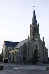 The church of Saint-Jean-Baptiste | |
Location of Ercé-en-Lamée | |
 Ercé-en-Lamée  Ercé-en-Lamée | |
| Coordinates: 47°49′51″N 1°33′28″W / 47.8308°N 1.5578°W | |
| Country | France |
| Region | Brittany |
| Department | Ille-et-Vilaine |
| Arrondissement | Redon |
| Canton | Bain-de-Bretagne |
| Intercommunality | Bretagne Porte de Loire |
| Government | |
| • Mayor (2020–2026) | Isabelle Bertin[1] |
| Area 1 | 39.21 km2 (15.14 sq mi) |
| Population | 1,550 |
| • Density | 40/km2 (100/sq mi) |
| Time zone | UTC+01:00 (CET) |
| • Summer (DST) | UTC+02:00 (CEST) |
| INSEE/Postal code | 35106 /35620 |
| Elevation | 23–107 m (75–351 ft) |
| 1 French Land Register data, which excludes lakes, ponds, glaciers > 1 km2 (0.386 sq mi or 247 acres) and river estuaries. | |
Ercé-en-Lamée (French pronunciation: [ɛʁse ɑ̃ lame], literally Ercé in Lamée; Gallo: Erczaé, Breton: Herzieg-Mez) is a commune in the Ille-et-Vilaine department in Brittany in northwestern France.
Geography
The river Semnon forms all of the commune's northern border.
Population
Inhabitants of Ercé-en-Lamée are called Ercéens in French.
| Year | Pop. | ±% |
|---|---|---|
| 1962 | 1,416 | — |
| 1968 | 1,542 | +8.9% |
| 1975 | 1,356 | −12.1% |
| 1982 | 1,253 | −7.6% |
| 1990 | 1,145 | −8.6% |
| 1999 | 1,156 | +1.0% |
| 2008 | 1,395 | +20.7% |
See also
References
- ↑ "Répertoire national des élus: les maires" (in French). data.gouv.fr, Plateforme ouverte des données publiques françaises. 13 September 2022.
- ↑ "Populations légales 2021". The National Institute of Statistics and Economic Studies. 28 December 2023.
External links
Wikimedia Commons has media related to Ercé-en-Lamée.
- Base Mérimée: Search for heritage in the commune, Ministère français de la Culture. (in French)
- Mayors of Ille-et-Vilaine Association Archived 2012-01-14 at the Wayback Machine (in French)
This article is issued from Wikipedia. The text is licensed under Creative Commons - Attribution - Sharealike. Additional terms may apply for the media files.