Romagné
| |
|---|---|
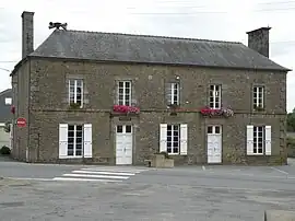 The town hall in Romagné | |
.svg.png.webp) Coat of arms | |
Location of Romagné | |
 Romagné  Romagné | |
| Coordinates: 48°20′35″N 1°16′34″W / 48.3431°N 1.2761°W | |
| Country | France |
| Region | Brittany |
| Department | Ille-et-Vilaine |
| Arrondissement | Fougères-Vitré |
| Canton | Fougères-1 |
| Intercommunality | Fougères Agglomération |
| Government | |
| • Mayor (2020–2026) | Cécile Parlot[1] |
| Area 1 | 26.93 km2 (10.40 sq mi) |
| Population | 2,440 |
| • Density | 91/km2 (230/sq mi) |
| Time zone | UTC+01:00 (CET) |
| • Summer (DST) | UTC+02:00 (CEST) |
| INSEE/Postal code | 35243 /35133 |
| Elevation | 57–171 m (187–561 ft) |
| 1 French Land Register data, which excludes lakes, ponds, glaciers > 1 km2 (0.386 sq mi or 247 acres) and river estuaries. | |
Romagné (French pronunciation: [ʁɔmaɲe]; Breton: Rovenieg; Gallo: Romanyaé) is a commune in the Ille-et-Vilaine department in Brittany in northwestern France.
Population
Inhabitants of Romagné are called Romagnéens in French.
| Year | Pop. | ±% p.a. |
|---|---|---|
| 1968 | 1,113 | — |
| 1975 | 1,311 | +2.37% |
| 1982 | 1,581 | +2.71% |
| 1990 | 1,591 | +0.08% |
| 1999 | 1,605 | +0.10% |
| 2007 | 1,953 | +2.48% |
| 2012 | 2,264 | +3.00% |
| 2017 | 2,404 | +1.21% |
| Source: INSEE[3] | ||
See also
References
- ↑ "Répertoire national des élus: les maires" (in French). data.gouv.fr, Plateforme ouverte des données publiques françaises. 13 September 2022.
- ↑ "Populations légales 2021". The National Institute of Statistics and Economic Studies. 28 December 2023.
- ↑ Population en historique depuis 1968, INSEE
External links
Wikimedia Commons has media related to Romagné.
- Base Mérimée: Search for heritage in the commune, Ministère français de la Culture. (in French)
- Mayors of Ille-et-Vilaine Association (in French)
This article is issued from Wikipedia. The text is licensed under Creative Commons - Attribution - Sharealike. Additional terms may apply for the media files.