Saint-Broladre
| |
|---|---|
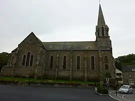 The church of Saint-Broladre | |
.svg.png.webp) Coat of arms | |
Location of Saint-Broladre | |
 Saint-Broladre  Saint-Broladre | |
| Coordinates: 48°35′15″N 1°39′19″W / 48.5875°N 1.6553°W | |
| Country | France |
| Region | Brittany |
| Department | Ille-et-Vilaine |
| Arrondissement | Saint-Malo |
| Canton | Dol-de-Bretagne |
| Intercommunality | Pays de Dol et Baie du Mont Saint-Michel |
| Government | |
| • Mayor (2020–2026) | Jean-François Gobichon[1] |
| Area 1 | 23.81 km2 (9.19 sq mi) |
| Population | 1,152 |
| • Density | 48/km2 (130/sq mi) |
| Time zone | UTC+01:00 (CET) |
| • Summer (DST) | UTC+02:00 (CEST) |
| INSEE/Postal code | 35259 /35120 |
| Elevation | 1–102 m (3.3–334.6 ft) |
| 1 French Land Register data, which excludes lakes, ponds, glaciers > 1 km2 (0.386 sq mi or 247 acres) and river estuaries. | |
Saint-Broladre (French pronunciation: [sɛ̃ bʁɔladʁ]; Breton: Sant-Brewalaer) is a commune in the Ille-et-Vilaine department in Brittany in northwestern France.
Population
Inhabitants of Saint-Broladre are called Broladrais or Broladriens in French.
| Year | Pop. | ±% |
|---|---|---|
| 1962 | 884 | — |
| 1968 | 946 | +7.0% |
| 1975 | 881 | −6.9% |
| 1982 | 865 | −1.8% |
| 1990 | 992 | +14.7% |
| 1999 | 1,014 | +2.2% |
| 2009 | 1,094 | +7.9% |
See also
References
- ↑ "Répertoire national des élus: les maires" (in French). data.gouv.fr, Plateforme ouverte des données publiques françaises. 13 September 2022.
- ↑ "Populations légales 2021". The National Institute of Statistics and Economic Studies. 28 December 2023.
External links
Wikimedia Commons has media related to Saint-Broladre.
- Base Mérimée: Search for heritage in the commune, Ministère français de la Culture. (in French)
- Mayors of Ille-et-Vilaine Association (in French)
This article is issued from Wikipedia. The text is licensed under Creative Commons - Attribution - Sharealike. Additional terms may apply for the media files.