| Scottish Gaelic name | Flodaigh |
|---|---|
| Old Norse name | Flot-ay |
| Meaning of name | raft island |
| Location | |
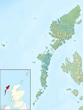
 Flodaigh Flodaigh shown within the Outer Hebrides | |
| OS grid reference | NB123413 |
| Coordinates | 58°16′N 6°55′W / 58.27°N 6.91°W |
| Physical geography | |
| Island group | Outer Hebrides |
| Area | <10 ha |
| Highest elevation | 22 metres (72 ft)[1] |
| Administration | |
| Sovereign state | United Kingdom |
| Country | Scotland |
| Council area | Comhairle nan Eilean Siar |
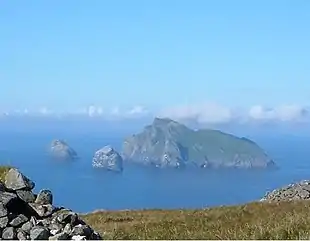
Flodaigh is an islet in outer Loch Ròg, Lewis, Scotland. It lies north west of Great Bernera and Little Bernera, south of Bearasaigh and Seanna Chnoc and west of Campaigh.
There are various islets and skerries surrounding the island including Fleisgeir, Sgeir an Saoidhean and the tidal Tamna.[1]
There is no regular access to the island although boat excursions are available locally.[2]
Notes
- 1 2 "Get-a-map". Ordnance Survey. Retrieved 31 July 2010.
- ↑ Haswell-Smith (2004) p. 312
References
- Haswell-Smith, Hamish (2004). The Scottish Islands. Edinburgh: Canongate. ISBN 978-1-84195-454-7.
58°16′03″N 6°54′29″W / 58.2674°N 6.9080°W
This article is issued from Wikipedia. The text is licensed under Creative Commons - Attribution - Sharealike. Additional terms may apply for the media files.
