Giuliano Teatino | |
|---|---|
| Comune di Giuliano Teatino | |
Location of Giuliano Teatino | |
 Giuliano Teatino Location of Giuliano Teatino in Italy 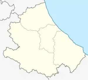 Giuliano Teatino Giuliano Teatino (Abruzzo) | |
| Coordinates: 42°18′N 14°17′E / 42.300°N 14.283°E | |
| Country | Italy |
| Region | Abruzzo |
| Province | Chieti (CH) |
| Frazioni | Madonna della Neve, San Cataldo, San Rocco |
| Area | |
| • Total | 9 km2 (3 sq mi) |
| Elevation | 270 m (890 ft) |
| Population (Dec. 2004)[2] | |
| • Total | 1,366 |
| • Density | 150/km2 (390/sq mi) |
| Demonym | Giulianesi |
| Time zone | UTC+1 (CET) |
| • Summer (DST) | UTC+2 (CEST) |
| Postal code | 66010 |
| Dialing code | 0871 |
| Patron saint | St. Anthony |
| Saint day | March 16 |
| Website | Official website |
Giuliano Teatino is a comune and town in the province of Chieti in the Abruzzo region of Italy. It is located on a hill between the streams Venna and Dendalo, tributaries of the Foro River, and is a medieval burgh dating from the 11th century. It was a fief, among the others, of the Orsini and the Caracciolo.
Notes
Wikimedia Commons has media related to Giuliano Teatino.
- ↑ "Superficie di Comuni Province e Regioni italiane al 9 ottobre 2011". Italian National Institute of Statistics. Retrieved 16 March 2019.
- ↑ All demographics and other statistics: Italian statistical institute Istat.
This article is issued from Wikipedia. The text is licensed under Creative Commons - Attribution - Sharealike. Additional terms may apply for the media files.