Guadalupe, Antioquia | |
|---|---|
Municipality and town | |
 | |
.svg.png.webp) Flag  Seal | |
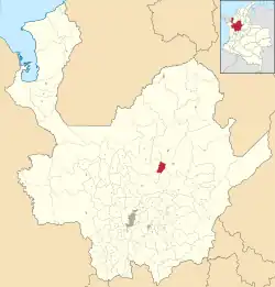 Location of Guadalupe in the Department of Antioquia. | |
 Guadalupe, Antioquia Location in Colombia | |
| Coordinates: 06°49′03″N 75°14′39″W / 6.81750°N 75.24417°W | |
| Country | |
| Department | |
| Subregion | Northern |
| Foundation | 1757 |
| Government | |
| • Mayor | César Augusto Agudelo |
| Area | |
| • Total | 87 km2 (34 sq mi) |
| Elevation | 1,875 m (6,152 ft) |
| Population (2002) | |
| • Total | 6,286 |
| • Density | 72/km2 (190/sq mi) |
| Time zone | UTC-5 (Colombia Standard Time) |
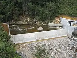
Guadalupe is a town and municipality in the Colombian department of Antioquia. Part of the subregion of Northern Antioquia, it lies at an elevation of 1,875 m (6,152 ft) above sea level.
External links
This article is issued from Wikipedia. The text is licensed under Creative Commons - Attribution - Sharealike. Additional terms may apply for the media files.